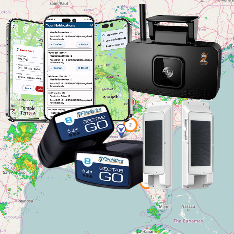
Vehicle theft or assets leaving a job site can cost a fleet thousands in lost money. Fleet geofencing creates a digital safety net by setting virtual boundaries that trigger real-time alerts the moment a vehicle crosses a line. These hidden borders turn GPS data into a tool for security, speed, and long-term asset care.
Fleet geofencing uses GPS or cellular data to create virtual borders around map areas for real-time tracking of any vehicle or asset. This system allows fleet managers to automate tracking by receiving sub-10 second alerts when vehicles enter or exit set zones like job sites or warehouses. According to Webfleet, geofencing creates these digital boundaries to help businesses improve security and verify proof-of-work with high speed and care. Advanced platforms support up to 200,000 imported zones to help firms manage work across the USA, Canada, and Mexico through automated reports. This basic telematics feature ensures that location data drives quick action for better fleet safety, theft prevention, and total daily work control for any size fleet.
Setting up these virtual zones is the first step toward a more secure and efficient business. Learning how fleet geofencing turns location data into action is the best place to start for any business owner. The path to a smarter operation begins with
How fleet geofencing turns location data into action
Fleet geofencing is a key tool for modern managers. It uses GPS and other signals to build a digital fence around a real place. When a vehicle crosses this line, the system sends an alert. This turns raw map data into a way to run your business better. It helps with security, proof of work, and site safety.
Creating virtual boundaries for your fleet
To start, you must define the areas that matter to your business. A geofence is a virtual boundary made using GPS, cellular data, or Wi-Fi. You can draw these zones around many types of physical sites:
- Job sites and construction yards
- Customer delivery locations
- High-risk zones or restricted areas
- Fuel stations and maintenance shops
Setting up these zones allows you to automate how you track each asset. You do not need to watch a map all day. Instead, the software tracks when a truck arrives or leaves a site. Some systems support a high number of zones. For example, large operations can manage up to 200,000 imported zones in their full fleet geofencing tools.
This is helpful for proving that work was done on time. It also helps with geofencing alerts for equipment security. If an asset leaves a yard at night, you will know right away. You can use custom shapes to fit the exact lines of your land or a specific job site.
Event-driven workflows and real-time alerts
The real power of fleet geofencing comes from its ability to trigger actions. When a driver enters a zone, the system starts a workflow. This can include sending a message to a client or logging a time stamp. Real-time alerts can reach you in less than 10 seconds for critical events. This speed is vital for keeping your crew safe and your assets secure.
Geofencing also helps reduce accidents in high-risk jobs like logging. Research from the Centers for Disease Control and Prevention (CDC) shows that geofences can define safe work areas. These virtual boundaries improve safety knowledge for workers on the ground. By setting up these zones, you can warn drivers before they enter a dangerous spot. This is a key part of using a fleet tracking system to protect your team.
Distinguishing map visibility from actionable data
Many people think geofencing is only about seeing a dot on a map. But true geofencing is about the data you get from those dots. Smart freight data helps operators cut down on office work and shorten cycle times for tasks. Instead of manual logs, you get automatic reports sent to your email. This shift from manual to automatic work makes your fleet faster.
You can set rules for each zone to avoid too many alerts. For instance, you might only want an alert if a truck stays in a zone for over an hour. This helps you find delays in your route. It turns simple location tracking into a smart way to manage your time and money. For government fleets, these tools are often ready through Sourcewell purchasing to make the setup process easy.
If you are not sure how to start, a 60-day pilot can show you the value. This trial lets you test zones on a few trucks before you roll them out to the whole fleet. This step ensures the alerts you set up provide the data you need to make better choices for your business every day.
Which geofence type fits each fleet workflow?
A geofence is a virtual boundary built with GPS or cellular data to track areas for comprehensive fleet geofencing capabilities. These boundaries help fleets improve security and stop theft. You can draw them around a job site, home, or office to automate your monitoring. Some systems can even handle up to 200,000 zones for large operations. Fleet managers use these tools to get timely data that boosts work speed.
Circular and polygon zones
Circular geofences are the easiest to set up. You pick a center point on a map and set a radius around it. These work well for simple tasks like seeing when a driver arrives at a store. But circles often cover too much ground or miss parts of a tight lot. In these cases, you may need a polygon zone. This type lets you draw custom lines to match the exact shape of a site or yard.
Polygon zones take more time to map out but offer better data. They can keep a close eye on high-risk areas. For example, some industries use them to define safe work spots for crews in high-risk jobs like logging. This helps everyone stay aware and safe on the job. Custom shapes make sure your alerts only trigger when a vehicle is truly inside the zone.
Route and dynamic geofences
Route geofences act like a corridor around a set path. If a vehicle leaves its assigned road, the system sends an alert. This is great for hauling high-value goods where you must stay on a specific track. It helps you find and stop improper use of company assets. You can also see if a driver takes a detour that costs you time and fuel.
Dynamic geofences are less common but very helpful for team safety. These zones move with a specific asset or person. They create a “bubble” that follows a vehicle as it travels. This tool can alert other drivers if they get too close to a moving work zone. It is a smart way to use live data to keep your team safe in the field.
| Geofence Type | Best Use Case | Setup Effort | Data Detail |
|---|---|---|---|
| Circular | Point-of-sale stops | Low | Basic |
| Polygon | Odd-shaped yards | Medium | High |
| Route | Fixed delivery paths | High | Precise |
| Dynamic | Mobile safety zones | High | Real-time |
Design arrival and departure alerts people can use
Fleet geofencing works best when alerts help you make quick choices. Most tools let you draw virtual lines around job sites or your home base. When a truck crosses these lines, the system sends a note. This helps you track work as it happens without making many phone calls. It gives you a clear view of your daily tasks.
You can set these alerts to go to your phone or your screen. To keep things clear, only send alerts for the most key sites. Too many notes can cause people to ignore them. Good design makes sure that your comprehensive fleet geofencing capabilities lead to real action. You should test your alert settings with a small group of drivers first.
Cycle times and entry flow
Entry and exit alerts show you how fast your team works. You can see when a driver gets to a site and when they leave. This data helps you find spots where work slows down. If a site always has a long wait, you can change your plan to save time. This leads to a faster day for everyone on the road.
Smart tools that use fleet data help you cut down on office work. According to Federal Highway Administration data, these tools can shorten wait times and reduce cycle times. Using these alerts lets you spot delays before they cost you too much money. You can also use this data to show proof of work to your clients if they have questions.
You might also use these notes to update your team in the field. When a driver enters a zone, the system can send a text to the site manager. This way, the team is ready to start work as soon as the truck arrives. This step removes the need for extra radio talk and keeps the flow smooth.
Dwell time and safety monitoring
Dwell time is how long an asset stays in one place. Long dwell times might mean a driver is stuck or has a problem. Alerts for dwell time can help you find idling trucks or late jobs. This keeps your team moving and saves on fuel costs. It also helps you see if you have enough staff for the work at hand.
Safety is another big part of tracking zones. You can mark off risky areas on the map to keep drivers safe. CDC research shows that geofences can define safe work areas and lower the risk of crashes. These alerts help protect both your people and your gear from harm.
You can also track how long a driver stays at a rest stop. This helps you manage driver fatigue and keeps your fleet in line with safety rules. If a stop lasts too long, a manager can check in to see if the driver needs help. These small checks lead to a much safer work place for your whole team.
After-hours and security alerts
Theft is a major risk for any fleet. After-hours alerts warn you if a truck moves when it should be parked. You can set a schedule so that any movement late at night sends a fast alarm. This helps you catch theft as it starts so you can call for help right away. It also stops people from using trucks for personal trips when they should be off the clock.
Quick notes are key for security. Most systems send these alerts in less than 10 seconds. You can also set alerts for when assets move too far from a set zone. This simple step gives you peace of mind and keeps your fleet safe day and night. It acts as a digital lock for your most costly gear.
Setting up steps to handle alerts is key. You should decide who gets the note first and what they should do. If the first person does not answer, the system can send the alert to a second manager. This ensures that every alarm gets a look and no asset is left at risk. A clear plan makes your geofencing tool much more strong and helps your team stay on top of any threat.
How does geofencing help detect unauthorized use?
Using geofencing alerts for equipment security is one of the best ways to stop wrong use. A geofence is a virtual wall on a map. It uses GPS and other signals to track where vehicles go. When a truck or trailer leaves a set zone, the system sends a note. This tool is a core part of stopping theft for modern fleets.
Fleet owners use this to find side jobs or personal trips. If a vehicle leaves a job site early, you will see it. It helps you keep assets where they belong. By setting these zones, you create a clear log of all movement. This makes it simple to spot trends of bad habits or trips that were not allowed.
Managing yard exits and restricted zones
The most common use of fleet geofencing is to track yard exits. You can draw a circle around your main lot. If a vehicle moves out of the lot after hours, the system sends an alert. Many platforms deliver these notes in under ten seconds. This speed allows for a fast response before a vehicle gets too far away.
You can also set up restricted zones. These are spots where your trucks should never go. It might be a rival lot or a high-crime area. If a driver enters these zones, you get a ping. This keeps your fleet on track and safe. It also helps with freight data tools by making sure trips stay on the right path.
Responding to theft and asset loss
If a thief takes a vehicle, geofencing helps you find it. You can see the exact spot where it left your zone. The system keeps a live log of the vehicle’s path. This data is vital for the police to find your gear. It takes the guesswork out of finding a stolen asset.
When setting geofence zones for assets, you protect more than just trucks. You can track trailers, generators, and large tools. This creates a safety net for your most costly gear. If a piece of gear moves without a work order, you will know. This helps lower the cost of lost items and insurance claims.
- Trailers: Track cargo and equipment on the move.
- Heavy Gear: Keep loaders and backhoes on the job site.
- Watercraft: Monitor boats and jet skis in the harbor.
Verifying alerts and protecting privacy
Not every alert means a theft is happening. Sometimes a driver starts a shift early or takes a new route. Managers should use a clear plan to check these events. This often starts with a quick call to the driver. This step respects privacy while keeping the fleet secure. It prevents false alarms and keeps trust within the team.
For large fleets, managing these alerts is easy with reports that go out by themselves. You can get a daily list of all zone use in your email. This lets you review the day without staring at a screen for hours. It provides a simple way to stay in control of your fleet’s security from any spot.
Build customer-service workflows around geofence events
Good service starts with good data. Many fleets use geofencing to track where vehicles go. But the real value is in how you use that data to talk to clients. When you link geofence events to your work, you stop guessing. You start giving clear, fast answers. This builds trust and keeps your buyers happy.
Automate arrival alerts for better ETAs
Most clients do not like to wait for a service call. They want to know when your team will be there. You can use comprehensive fleet geofencing capabilities to send auto alerts. Set a large zone around a job site. When a truck enters that zone, the system can send a text. This gives the client a real-time update that the driver is close. This type of speed helps your fleet look like an expert team.
This approach also helps your office staff. They spend less time answering “where is my driver?” calls. Instead, they can focus on new sales or planning routes. By using these alerts, you keep data flowing without extra work. It turns a manual task into a smooth process for all.
Verify service with dwell time data
Proving that a job was done is a major part of service. Sometimes a buyer might claim a driver never showed up. Geofence dwell time logs give you the proof you need. You can show exactly how long a vehicle stayed at a site. This data acts as a digital receipt for your work. These smart tools make it easy to share this info. It cuts down on billing talks and helps you get paid faster.
You can use this data to find ways to work better. For example, you can track:
- How long it takes to unload at a site.
- The time spent on rest breaks versus work time.
- When a tech arrives at the first job of the day.
- If a vehicle stays at a yard longer than it should.
Using dwell times helps you set fair prices based on real data. It ensures you get paid for the actual time spent on the job. This makes your business more fast and keeps your costs low.
Manage delivery issues in real time
Not every day goes as planned. Traffic or weather can cause delays. A good team spots these issues before the client does. With real-time alerts, you can see if a driver is stuck or off track. If a vehicle stays in a geofence too long, your team gets a note. This lets you call the client and explain the delay. Being early shows that you care about their time and their goals.
Handling issues fast is a way to stand out. You can use geofencing as a telematics feature to keep your team on schedule. If one truck is late, you might be able to send a new truck that is nearby. This level of control keeps your service level high. It turns a bad loss into a win for your team.
Turn geofence events into useful fleet reports
Data from fleet geofencing only helps your business if you turn it into useful reports. Raw alerts tell you when a truck enters or leaves a zone, but reports show you patterns over time. These reports help you spot trends that you might miss by looking at single events. By using these tools, you can change how your team works without watching every move.
Analyze time on site and missed stops
One of the best ways to use zone data is by looking at dwell time. This metric shows how much time a driver spends inside a set zone. If a driver stays at a job site too long, it might mean there is a delay in your plan. Short visits could also mean the work was not done right. Reports on visit time help you balance your schedule and set better goals for your crew.
You can also use reports to find missed stops. The system compares your list of known zones to the actual path of your trucks. If a truck drives past a planned stop without entering the zone, you will see it on your report. This level of comprehensive fleet geofencing capabilities helps you ensure that all tasks get done. High-quality tools that use freight data can also help you reduce office work. According to the Federal Highway Administration, these tools help shorten cycle times and cut down on desk tasks.
Monitor after-hours movement and security
Geofences work well for more than just daytime jobs. You can set up zones to track where your assets go at night or on weekends. If a trailer or piece of gear moves when it should be parked, the system sends a quick alert. This is a key part of stopping theft and keeping your tools safe. It is much easier to find a stolen asset when you know the exact second it left your yard.
Reviewing these logs also helps you find wrong use of your company trucks. If a driver takes a van home without a permit, a report will show that trip. Using geofencing alerts for equipment security ensures that your high-value gear stays in place. This kind of tracking is vital for safety and proves when work was done. These tools provide timely data that improves how well your fleet runs.
Use data for process coaching
The goal of using fleet geofencing data should be to help your team. Do not just use it to catch small mistakes. Instead of blaming a driver for one late stop, look at the trend over a full month. Frequent delays at one site might mean the site is hard to reach. You can use this data to coach your drivers on better routes. You can also talk to your clients about how to get in and out of their lots faster.
Using reports to improve your process shows that you value your team’s time. It moves the focus from “watching” to “helping.” This approach fits with the idea of being flexible while still getting results. By sharing these reports with your drivers, you can work together to find ways to work better. Good data makes these talks easier because they are based on facts rather than guesses.
How to run a fleet geofencing pilot program
Before you roll out virtual boundaries to your whole fleet, a pilot program helps you find the best way to use the tech. A small test lets you see how alerts work without overwhelming your team. It also shows the clear value of geofencing as a telematics feature for your specific business needs.
Setting the scope for your test
Start with a clear business question, such as whether alerts can reduce idle time at job sites. Choose a small group of vehicles or a single site to test the system. This keeps the data clean and makes it easier to manage the pilot. By focusing on a narrow scope, you can better track how freight tools help productivity during the trial period.
Managing the 60 day evaluation
Fleetistics offers a 60-day Solution Evaluation Process to help you test these tools in the real world. During this time, you should set clean boundaries on your map and assign owners to each alert. Ensure your drivers know why you are using the tech to help with safety and efficiency. This open talk prevents pushback and helps you gather better feedback on the tool.
- Define your goals: Pick two or three metrics to track, such as arrival times or proof of work.
- Select your vehicles: Use a subset of your fleet that works in a high-traffic or high-risk area.
- Set up alerts: Create zones around your key sites and set up fast alerts for critical events.
- Notify your team: Talk to your drivers about how comprehensive fleet geofencing capabilities support their daily tasks.
- Monitor the data: Review your reports weekly to see if the geofences are catching the right activity.
- Analyze results: Compare your pilot data to your baseline metrics to see if the tech meets your needs.
- Decide to scale: Use your findings to decide if you should roll out the zones to the rest of your fleet.
Measuring success and next steps
Check your baseline metrics against the pilot data to see the true impact of the zones. If you see a drop in off-task stops or better arrival times, you have proof the system works. You can then use these wins to justify a full launch. This data-led approach ensures that your fleet geofencing for safety and efficiency provides a strong return on your investment.
Frequently Asked Questions
Can fleet geofencing help with tax and regulatory compliance?
Yes. Many managers use these tools to track vehicle miles by state or region. This data is vital for fuel tax reporting and other local rules. According to the DOT, tools that use freight data help reduce office work and processing times. This ensures your fleet stays within the law without adding more manual logs to a driver’s daily tasks.
Does fleet geofencing work for construction equipment or watercraft?
Fleet geofencing is not just for trucks and cars. It also works for heavy equipment, trailers, and even boats. These systems use GPS or cell signals to track any asset with a power source or a battery tag. By setting virtual walls around a job site or dock, you can protect high-value tools. This helps stop theft and ensures gear stays in the right place when not in use.
How does geofencing improve billing accuracy for customers?
Virtual boundaries help you prove exactly when a tech or driver arrived and left a job site. This data acts as a timer for proof of work. You can use these logs to settle billing talks and show clients that you met your goals. Since the system tracks arrival and exit times fast, you can provide clear invoices based on facts. This builds trust with your customers and speeds up your pay.
What is a geofencing tracker?
A geofencing tracker is a tool put on an asset to send location data to a computer. These tools use GPS or cell signals to create a virtual line around a real place. Once an asset moves over that line, the tool sends an alert. Some trackers plug into a truck. Others use long-life batteries to watch trailers or tools that do not have their own power.
Are you ready to start your fleet geofencing pilot?
Leaving your trucks without geofencing is a big risk. Your firm stays open to theft and fuel waste each day. Every hour you wait is an hour with no control. You have no way to stop the wrong use of trucks. Without these tools, you lack the data to make safe choices. If you do not start now, these hidden costs will grow. Do not let more cash slip away due to unknown driving habits. Using GPS tracking tools lets you see real results in just weeks. You can stop losses and gain the clear proof of work you need for your fleet.
Ready to book a consultative demo? Book a consultative demo on our contact page to see how we can help your fleet.