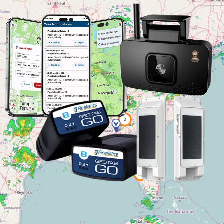

Public works salt spreading works better when the forecast, the route, and the truck location answer the same question: where should this load go next? A blanket pass wastes salt on roads that stay clear and leaves the hardest-hit streets waiting. Pair a snowfall and ice forecast with live truck locations and a route you can change, and the crew puts material where the weather calls for it.
Talk with a fleet consultant about winter operations
Why does public works salt spreading waste material?
Most waste starts before the first truck leaves the yard. A storm rarely hits a county evenly. One ridge ices over while a valley road stays wet, and a north-facing stretch freezes hours before the rest of the route. A static beat sheet cannot see that difference, so every spreader runs the same loop at the same rate.
The cost shows up in three places. Salt piles shrink faster than the weather justifies. Drivers spend hours on roads that did not need a pass. The streets that did need one wait, and residents notice the gap. The Federal Highway Administration treats winter maintenance as a placement decision. Managers use route-specific weather and resource data to choose where sand, salt, and anti-icing chemicals belong. The alternative is treating every mile the same way.
A useful public works salt spreading plan starts with that decision, not with a bigger purchase order. You need a forecast tied to the roads you maintain, a way to see which trucks are already out, and a route you can change when the storm shifts. Those three pieces are fleet weather intelligence, live telematics, and routing. None of them replaces a supervisor’s judgment. Together they give that judgment current facts.
How do you put salt only where the forecast calls for it?
Start with the forecast you will actually act on. A regional snow total is too coarse for a salt decision. What you need is the timing of snowfall and ice on the corridors, bridges, hills, and shaded stretches your crew owns. Hyper-local forecasts and weather alerts, the kind a fleet weather intelligence view is built to show, tell you which of those segments will freeze and which will not.
Then match the material to that segment. A light pass ahead of freezing drizzle is a different job from a heavier pass after a band of snow. When the forecast names the roads, you stop salting the ones it leaves out. That is the first saving: salt goes where snowfall and ice are expected, and it stays in the pile everywhere else.
Keep a simple record of the call. Note the forecast you used, the segments you treated, and the rate you chose. After the storm, compare that note with what actually fell. That comparison tightens next week’s plan. It is also the evidence you need when a resident asks why one road was treated and another was not.
How do you monitor salt spread by area and weather?
A plan only helps if you can see what the trucks did with it. Monitoring means watching material go down by area, against the weather in that area, while the shift is still running. Location data from the truck shows which segment was covered and when. The weather layer shows whether that segment was the one the forecast flagged.
Read the two together. A spreader that finished its loop early may have skipped the hill that was forecast to ice. A truck that sat in one neighborhood may have over-treated a road the forecast had already cleared. Either finding is useful only if you see it before the shift ends, so you can send the truck back or tell it to stop.
This is also how you explain the work later. A map of where trucks were, set next to the weather they were responding to, is a clearer record than a handwritten tally of loads. Supervisors can review the shift the same day. Public works directors can show that salt moved with the storm instead of with a fixed route.
| What you watch | What it tells you | What you do next |
|---|---|---|
| Forecast versus segments treated. | Whether salt landed on the roads the weather called for. | Add the missed segments or stop the extra passes. |
| Truck location during the shift. | Which areas are covered and which are still open. | Move the nearest loaded truck, not the one parked at the yard. |
| Time trucks sit between passes. | Where equipment is idle while other roads stay untreated. | Restage that truck closer to the next demand. |
| Loads used against the storm that fell. | Whether the rate matched the weather. | Adjust the rate for the next band of snow or ice. |
How should you route spreaders around weather patterns?
Routing is the step that turns a forecast into a driving order. Build the route from the weather pattern, not from last year’s beat. If the ice line is moving from west to east, the first trucks should be on the western ridges and bridges, and the eastern loop can wait. If a band stalls over one township, that township gets the second pass before anyone starts a courtesy loop elsewhere.
A route you can change matters more than a perfect route you printed at dawn. Storms shift. A dispatcher who can see both the weather and the trucks can swap the order, split a long loop, or hold a truck for the next band. Geotab routing is built for that kind of dispatch. Plan the stops, then adjust them as conditions change, instead of locking the crew into a stale sequence.
Give drivers the reason with the route. “Start on the shaded hill, then the bridge, and skip the south grid until the next update” is a better instruction than a list of street names. Drivers who know why the order changed are less likely to “correct” it back to the old loop. The Geotab routing and dispatch overview is a useful companion when you want to see how planned routes and live dispatch fit together.
Where should you stage equipment and drivers before the storm?
Staging is the decision you make before the first flake, and it decides how fast the first response is. Park loaded trucks and rested drivers near the roads you expect to treat first. A spreader that starts the storm fifteen miles from the hard-hit area spends its first half hour driving, not treating. Those are the miles where plows sit idle while the streets that need them stay covered.
Use the forecast to pick the staging points, and use locations from the last shift to see which yards and pull-offs are actually available. A satellite lot on the north end is only useful if a truck and a driver can reach it before the roads they will treat become the problem. Stage in daylight when you can. Moving equipment during the storm costs time you needed for the response.
Write the staging plan down and share it. Name the lot, the truck, the driver, and the roads that crew owns for the first two hours. When the storm arrives early, nobody should be calling around to find out who is closest. The point of staging is that the closest crew is already there.
How do you keep salt and trucks allocated fairly?
Equitable allocation is a record, not a slogan. Residents compare their street with the next one, and council members ask why one district was treated twice while another waited. You can answer that only if you can show where the salt and the trucks went, and what weather justified it.
Set the rule before the season. Primary routes, hills, bridges, school and hospital approaches, and known trouble spots come first. Neighborhood grids follow, in an order you publish. Then track the work against that rule. If one district received more loads, the weather map should show why. If it does not, you have a dispatch problem to fix, not a complaint to deflect.
Review the allocation after each storm, not at the end of winter. A single storm is enough to see whether one area is quietly absorbing extra passes out of habit. Move the next storm’s plan to correct it. Fairness is easier to defend when it is visible in the same view as the trucks and the weather.
How do road rangers keep plows and spreaders moving?
Spreaders and plows only clear roads when they can reach them. Stalls, stuck vehicles, blocked intersections, and drivers who need a hand all take a truck out of the fight. Road rangers, the support units that handle those problems, are part of the salt plan even though they carry no material.
Deploy them where the weather is worst and where the plows need a clear path. A ranger parked at the main yard cannot help a spreader stuck on a ridge road. Use the same forecast and the same truck map: send support toward the hardest-hit areas first, and toward the corridors the plows and spreaders must use to get there. The goal is open roads for the trucks that do the clearing, not a separate patrol with its own route.
Tell the ranger crews the same staging story. If the plows are pre-positioned on the north end, support should be pre-positioned there too. A support unit that has to cross the county after the call is as late as the spreader it was meant to free.
How does staging clear more roads and make them safer?
Clearing more roads is the result of the earlier decisions, not a separate program. When salt follows the forecast, trucks run routes that match the weather. Idle equipment moves before the storm, and support keeps the paths open. More of the network gets a timely pass. A treated road is a safer road. A road treated early is safer than one treated after the ice has bonded.
The failure mode is easy to picture and easy to measure. A plow idling far from the hard-hit streets treats nothing while it sits. The same truck, staged near the demand, is already engaged when the snow arrives. You do not need a new fleet to close that gap. You need the trucks you have to start the storm in the right place, with a route that still makes sense an hour later.
Track one number after each event: how long the priority segments waited between the start of the weather and the first pass. A shorter wait, with fewer wasted loads on segments the forecast never flagged, is the result you can show. It is also the result residents feel.
What does a public works crew need in the cab and the office?
The office needs one picture that combines weather, routes, and truck locations. The cab needs directions that match that picture, plus a way to hear about a change without a string of phone calls. A platform that already ties location, dispatch, and alerts together is the practical base. The Geotab GO platform is that base for many public works fleets: the device reports where the truck is, and the office works from the same map the driver is on.
Add weather as a layer rather than a separate tab nobody checks. Weather by CrewChief on the Geotab Marketplace brings forecasts and road-risk views into the Geotab map. A dispatcher can see a truck and the weather on its route together. Fleetistics can walk a public works team through whether that add-on fits the way the crew already dispatches.
Geotab customers can try Weather by CrewChief free for 30 days from that Marketplace listing. Fleetistics confirmed on November 17, 2026, that everyone on the Geotab Marketplace gets a free 30-day trial. Start the trial from the listing, then talk with Fleetistics about how the weather view fits your salt routes.
You do not have to redesign the whole winter program to start. A focused evaluation of about 30 days is enough for an ordinary fleet to test staging, routing, and weather on a handful of real storms. Very large or government fleets sometimes need a longer look. Pick the storms, name the segments, and judge the result on salt used and time to first pass.
How do you introduce this to drivers and the public?
Drivers are the people who make a changed route real. Tell them what is changing and why before the first storm, not over the radio during it. A short briefing prevents most of the friction. Cover how locations are used, what “skip this grid” means, and who to call when the route does not match the road. A written driver policy and a plain explanation when you are introducing GPS tracking give crews the same story you would want if you were in the cab.
The public deserves a simpler version of the same story. Say that primary roads, hills, and bridges come first, that neighborhood streets follow a published order, and that storms decide the pace. Point people to the department, not to a promise that every street will be clear at the same minute. The departments that take the fewest angry calls are the ones that explained the order before the snow.
A storm-week checklist for public works salt spreading
- Read the snowfall and ice forecast down to the segments you maintain, and mark the ones that need treatment.
- Set the route order from that pattern, and leave room to change it when the band shifts.
- Stage loaded trucks and drivers near the first-priority roads, not at the far yard.
- Place road-ranger support with those trucks so plows and spreaders can reach the work.
- During the shift, compare where salt went with the weather that was forecast for that area.
- After the storm, review loads and wait times, and correct the allocation before the next event.
Salt spreading for public works is a placement problem. Forecasts choose the roads, routing sets the order, telematics shows whether the trucks followed it, and staging decides how fast the first pass starts. Get those four right and you use less salt and clear more of the network. You also spend less of the storm with equipment sitting far from the roads that need it.
Fleetistics has helped fleets with this kind of operations question since 2001, including government and municipal crews. If you want a second set of eyes on your staging plan, your routes, or the weather view your dispatchers use, talk with a consultant before the next storm.
Book a demo to review your winter salt plan
Frequently asked questions
Does every public works truck need an ELD for salt season?
No. An ELD is for hours-of-service compliance on covered long-haul and interstate operations. Many local salt and plow crews are short-haul and are not making an ELD decision when they add location and weather tools. Confirm your own operations against the FMCSA rules rather than assuming a winter program requires one.
Can weather data alone cut the salt we use?
Not by itself. A forecast tells you where ice and snow are likely. You still need routing to send trucks there and location data to confirm they went. The saving comes from treating the forecast roads and skipping the others, then checking that the shift matched the plan.
How is this different from a winter operations product page?
A product page lists the tools. This is the operating method: how to place salt, change routes, stage trucks, and keep the allocation fair. For the broader public works picture, the public works fleet management guide and the winter operations overview cover the program around the salt decision.
What should we measure after the first storm?
Measure two things. Count the loads used on segments the forecast did not flag, and time how long priority roads waited for a first pass. Fewer wasted loads and a shorter wait are the signs the plan worked. Automatic vehicle location makes both measurements possible without riding along.
Where do we start if the season has already begun?
Start with the next storm, not with a new system rollout. Pick the staging points, rewrite one route from the forecast, and review the result the morning after. A government fleet team can add tools after that review shows where the current process loses time or salt.