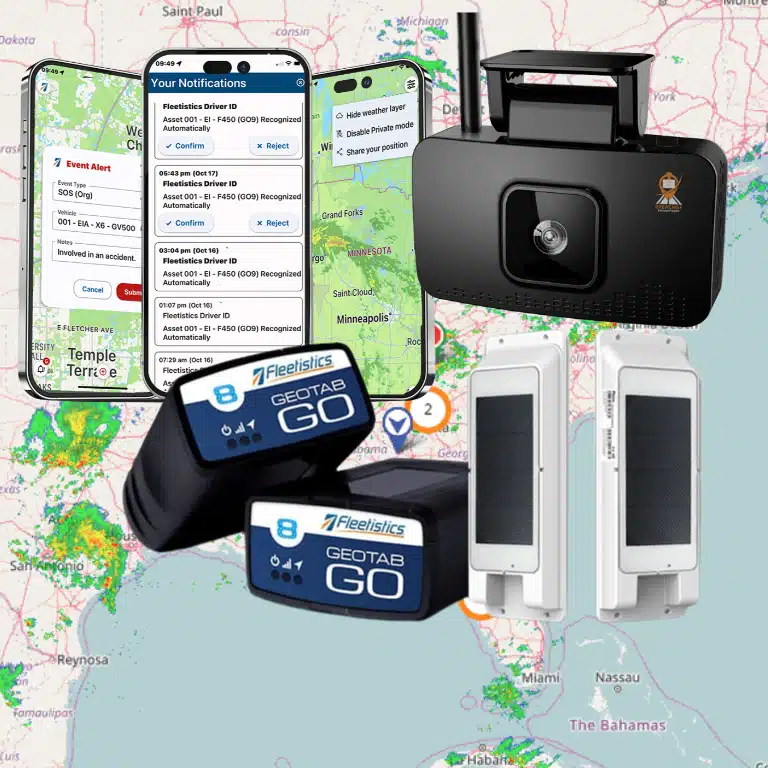

A route plan is only as useful as your ability to see what happens after vehicles leave the depot. GPS location, trip history, traffic, driver availability, and customer commitments give dispatchers the context to adjust a working day instead of relying on yesterday’s assumptions.
GPS fleet tracking route optimization works as a continuous loop: tracking data shows where vehicles are. Route tools compare that reality with the plan, and dispatchers can respond to delays, deviations, or last-minute requests. The same records then help you measure mileage, drive time, on-time completion, and cost-to-serve, so improvements are evaluated against your fleet’s baseline rather than promised in the abstract.
Talk with Fleetistics about a practical implementation
The value comes from connecting data to daily decisions, from the initial route design through driver communication and post-route review. Here is how that connected workflow supports route optimization in daily operations.
How Does GPS Fleet Tracking Support Route Optimization in Daily Operations?
GPS fleet tracking makes route optimization a continuous operating loop: capture where vehicles are, compare actual trips with the plan, adjust when conditions change, and review the results after the route. Instead of treating a route as fixed once a driver leaves the yard, your team can use current operating data to make better decisions throughout the day.
Telematics systems transmit near-real-time GPS location and vehicle data to a cloud platform. In practical terms, dispatchers can see vehicle positions, review trip history, and identify where the day is diverging from the expected route.
Start with the planned route, then measure what actually happened
Before optimizing, establish a usable baseline. Record the intended stops, sequence, arrival windows, expected mileage, and planned drive time. After the route, compare those expectations with the GPS trail. Repeated deviations may point to an unrealistic sequence, avoidable backtracking, excessive dwell time, or a constraint that was missing from the original plan.
This comparison is more useful than a dashboard that only shows dots on a map. It turns location history into an operational question: which route decisions helped the driver complete the work, and which created extra time or mileage? Keep the review focused on process improvement, not blame. Employees should understand what data is collected, why it supports service and safety, and how access is governed.
Adjust when the operating conditions change
Traffic, weather, driver availability, and last-minute customer requests can make a morning plan outdated. The U.S. Environmental Protection Agency notes that many route platforms combine real-time fleet information with traffic and driver availability to adjust routes dynamically, while also alerting managers to route deviations. The EPA SmartWay route-optimization resource also emphasizes adapting to changing orders and conditions.
The goal is not to reroute every vehicle constantly. It is to give dispatch and drivers reliable information for exceptions, then use the completed trip record to improve tomorrow’s plan.
What Data Turns a Planned Route Into an Executable One?
A route becomes useful when it reflects the conditions your team must meet, not just the shortest distance between stops. Orders, delivery windows, vehicle characteristics, road restrictions, and hours-of-service limits all shape whether a plan can be completed as scheduled. The EPA describes these factors as core inputs for creating efficient delivery routes.
Operational planning also has to account for vehicle capacity, driver availability, customer preferences, road speeds, and weather. A route that looks efficient on a map may fail when a vehicle cannot carry the required load. When a driver’s shift ends, or when a customer is available only during a narrow window.
Route inputs and the operational decisions they support
| Route input. | Operational decision. |
|---|---|
| Orders and stop locations. | Which deliveries, pickups, or service calls belong on each route. |
| Delivery windows and customer commitments. | Stop sequence and arrival timing needed to protect service levels. |
| Vehicle capacity and product requirements. | Which vehicle can carry the load and complete the assigned work. |
| Driver availability, shifts, and breaks. | Whether the itinerary can be completed within available work time. |
| Road restrictions, speeds, and weather. | Which roads are practical and when the plan needs adjustment. |
These inputs create a set of constraints rather than a single ideal path. Vehicle-routing models aim to honor customer time windows while keeping route operating and investment costs controlled. They also account for available resources, driver shift limits, driving speeds, and customer commitments. In practice, that means dispatchers can evaluate whether the plan is executable before assigning it to a driver.
The EPA notes that manual planning is harder to adapt when weather, traffic, or customer orders change. Connecting planning inputs with GPS fleet tracking route optimization gives the operations team a way to compare the plan with live conditions and make a defensible adjustment when the day does not unfold as expected. Read the EPA route-optimization guidance for additional context on these planning factors.
How Does the Tracking-to-Route Workflow Work During a Service Day?
A connected workflow turns a route from a static plan into an operating reference. The dispatcher compares the planned sequence with live vehicle movement, responds to exceptions, and reviews the completed trip for the next planning cycle.
- Establish the baseline. Before vehicles leave, confirm the assigned stops, service windows, vehicle, driver, expected mileage, and route priorities. Historical trip records can show where similar routes typically run long or deviate. This gives the team a practical reference instead of relying on memory.
- Build the day’s plan. Use available orders, driver availability, vehicle limitations, customer commitments, and known restrictions to create an executable sequence. A route that looks efficient on a map still needs to fit the resources and time available.
- Dispatch with clear expectations. Share the route, stop sequence, timing requirements, and any changes with the driver before departure. Employee understanding matters. Explain what location data is collected, why it supports safety and service, who can access it, and how long records are retained. Written notice, consistent policies, and a channel for questions help build buy-in.
- Monitor progress against the plan. Live GPS visibility lets dispatch see vehicle position, trip history, and route movement. Dashboards and automated mileage records can reduce manual reporting, while geofences or deviation alerts can identify issues that need attention. See Fleetistics’ fleet data analysis resources for the broader measurement layer.
- Manage exceptions, not every turn. When traffic, weather, a missed appointment, or a last-minute customer request changes the day, reassess the remaining stops and communicate the decision. Route-optimization systems can support dynamic adjustments and help teams predict delays so customers receive proactive updates. Governance should also define when dispatch may change a route and when customer or manager approval is required.
- Close out and learn. At day’s end, compare the planned route with the actual trip. Record completed stops, delays, mileage, dwell time, exceptions, and customer-impacting changes. Historical records make it easier to refine future routes, investigate recurring problems, and distinguish a one-time disruption from a process issue.
How Should Fleet Teams Implement the Combined Workflow?
Start with one operational problem, not a device catalog. Decide whether the priority is reducing avoidable miles, improving arrival consistency, supporting dispatch, or giving managers a clearer view of route execution. Define the routes, vehicles, drivers, and customer commitments that will show whether the workflow is working.
Next, establish a baseline. Record representative miles, drive time, on-time completion, route deviations, exceptions, and manual planning effort before changing the process. A baseline gives your team something more useful than a general impression when it compares planned routes with actual trips.
Match data collection to the fleet
Review vehicle age, makes and models, operating environments, connectivity, and the data needed for route decisions. Telematics commonly transmits near-real-time GPS location and vehicle diagnostic data to a cloud platform. Deployment choices can include factory-installed OEM systems, aftermarket equipment, or other installation modes. OEM telematics may integrate closely with vehicle systems and support over-the-air updates, but they can be less customizable or inconsistent across different makes and models. Hardwired options should be evaluated as a configuration tradeoff, not automatically treated as an upgrade.
Map the systems that need to exchange information, such as dispatch, maintenance, customer notifications, and reporting tools. A platform that fits your existing workflow is more valuable than one that creates another isolated dashboard. Fleetistics can help teams review GPS tracking deployment guide considerations and assess telematics implementation fit.
Pilot before you scale
Use a representative route group for the evaluation. If you use an evaluation period, 30 days is the ordinary standard for a typical fleet context, provided the team has enough operating data to compare conditions fairly. Include dispatchers and drivers early. Explain what is collected, why it matters, how alerts are used, and how employees can raise concerns. Transparent notice and practical training build buy-in better than presenting tracking as surveillance.
Coordinate fleet, IT, and cybersecurity stakeholders before expansion. Document access rules, retention expectations, alert ownership, and exception-handling procedures. Review the pilot against the baseline, adjust the workflow, and scale in stages so training, governance, and support keep pace with the fleet.
How Do You Measure GPS Fleet Tracking and Route Optimization ROI?
Measure the combined workflow against a baseline, not against an assumption. Capture several representative weeks before changes are introduced, then compare the same operating period after routes, dispatch practices, and driver communication have stabilized. This makes the result useful for your fleet rather than borrowed from a generic savings claim.
Use a checklist that connects operating activity to financial impact:
- Planning and editing hours: Measure how much dispatcher time goes into route creation, manual editing, reassignments, and exception handling before and after automation. Hours saved can be one of the most significant returns from routing software because they increase planning capacity without requiring the same work to be repeated. For an example of measurable routing impact, review Fleetistics’ University of Rochester Route4Me success story.
- Miles and drive time: Compare total miles, miles per stop, and drive time for similar routes. Route optimization is intended to reduce unnecessary travel, while GPS history helps you see whether actual trips followed the plan. The EPA notes that route optimization can reduce travel by about 2,500 miles per year for the average driver in its stated context. But your result will depend on route density, geography, and operating rules. Review the EPA route-optimization findings.
- Fuel and cost per mile: Track fuel use alongside miles, idling, and vehicle type. Do not treat a lower fuel bill as proof of route improvement until you account for workload, seasonal demand, and fuel prices. Use your fleet fuel economy factors as part of the analysis.
- On-time completion and route adherence: Record completed stops, missed windows, arrival variance, and the percentage of planned route completed. Separate unavoidable exceptions from avoidable deviations so the team can improve the plan without penalizing drivers for conditions outside their control.
- Exceptions and utilization: Count unplanned stops, route deviations, repeat visits, vehicle idle time, trips per vehicle, and days in use. Mileage and trip-frequency data can reveal underused vehicles, surplus capacity, or workloads that are concentrated on too few units. Fleet data analysis can help connect those patterns to planning decisions.
- Cost-to-serve: Translate the changes into cost per route, stop, delivery, or service call. EPA guidance describes cost-to-serve analysis using required miles, trucks, and drivers, and recommends scenario modeling across vehicle capacity, delivery days, and customer locations. See the EPA guidance on routing costs and scenarios.
Review the dashboard at a consistent cadence, and annotate major changes such as new territories, staffing shifts, weather disruptions, or demand spikes. That context prevents a single favorable week from being mistaken for durable ROI.
Contact Fleetistics to discuss a measurable fleet tracking and route optimization evaluation.
What Should You Look for in a Platform and Implementation Partner?
A strong platform should help your team move from location data to better decisions, not simply display vehicles on a map. Look for live visibility, route history, and reporting that lets you compare planned routes with actual trips. That comparison can reveal avoidable mileage, delays, dwell time, and recurring service issues that are easy to miss during a busy day.
Fit also depends on how well the platform reflects your operating constraints. Ask whether it can work with delivery windows, vehicle characteristics, driver schedules, customer commitments, and changing field conditions. Confirm how it connects with your dispatch or transportation systems, whether documented integrations and APIs are available. And how permissions support the people who need data without exposing everything to everyone. A useful TMS and fleet telematics connection should make routing, dispatch, visibility, and reporting part of one practical workflow.
Can the platform grow with your operation?
Modular tiers matter because a small field-service fleet may need route history and essential visibility, while a larger operation may require deeper analytics, routing, integrations, and workflow controls. Do not choose features only because they appear on a checklist. Match the tier to the decisions your team needs to make now, then confirm how easily you can add capabilities as routes, vehicles, or reporting requirements change.
What does the implementation partner actually own?
Technology alone does not create adoption. Your partner should help define the use case, configure the workflow, train dispatchers and drivers, establish reporting expectations, and support ongoing refinement. Employee governance belongs in that conversation too. Drivers and other tracked employees should receive clear notice about what is collected. Why it is used, who can access it, and how the information supports safety and operations.
Fleetistics combines Geotab-powered technology with implementation, training, and customer support. As a Geotab reseller and implementation partner, Fleetistics helps you select and configure a fit-for-purpose solution while advocating for your fleet. For teams connecting routing, analytics, maintenance, or permissions, review the options for advanced fleet management workflows before choosing a rollout path.
Frequently Asked Questions
How does GPS tracking improve route decisions during the day?
GPS tracking shows where vehicles are, what routes they completed, and where delays or deviations occurred. Dispatchers can compare actual progress with the plan, communicate changes, and use the resulting history to improve future schedules. Some platforms also adjust routes using live traffic and driver availability, as described by the U.S. Environmental Protection Agency: EPA route optimization guidance.
What information is needed to optimize a multi-stop route?
Start with orders, customer time windows, vehicle capacity and characteristics, driver availability, road restrictions, and any applicable hours-of-service limits. Weather, road speeds, and customer priorities may also affect the sequence. The more accurately these constraints reflect daily operations, the more practical the proposed route becomes.
How can a fleet measure whether the workflow is working?
Set a baseline before implementation, then compare miles traveled, drive time, fuel use, on-time completion, route adherence, exception rates, utilization, and cost to serve. Review results by vehicle, route, and service type instead of relying on one fleet-wide average. This approach shows where the combined workflow is creating value and where adjustments are still needed.
How should drivers and employees be included in a tracking rollout?
Explain what data is collected, why it supports dispatch and service quality, who can access it, and how it will be used. Give drivers a clear process for reporting route constraints or inaccurate information and document appropriate monitoring rules before launch. Transparent notice and practical training improve buy-in and help the team use route changes constructively.
Ready to Connect Fleet Tracking With Better Route Decisions?
A practical workflow can help you connect daily location data, route changes, driver communication, and ROI measurement without forcing a one-size-fits-all process. Contact Fleetistics to discuss a GPS fleet tracking and route optimization approach matched to your routes, operating constraints, and goals.