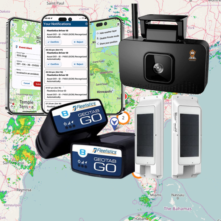


A real time obd gps tracker for fleet use can help dispatchers find vehicles and respond to changing work, but “real time” does not describe one guaranteed update speed. An OBD tracker is a practical fit only when its reporting behavior, vehicle compatibility, and installation approach meet your needs. Start by defining which decision the location data should support, then test that decision with representative vehicles.

Discuss your fleet tracking needs
What does real-time OBD fleet tracking actually show?
An OBD tracker connects through a vehicle’s diagnostic port and reports location to a tracking platform. GPS is the satellite-based positioning system behind many location services; the U.S. government’s GPS information site provides an overview of the system. A platform may also display selected vehicle information, depending on the device, vehicle, configuration, and service. The exact data available should be confirmed for the proposed setup rather than assumed from the name of the device.
A map marker is not automatically a continuously refreshed position. The tracker may report on a configured interval, when a defined event occurs, or according to another device setting. Network coverage and processing also affect when a report reaches the platform. In practice, the screen may show the latest location known to the system, not a position measured at that exact moment.
For dispatch, the distinction matters. If a dispatcher sees a vehicle near a job, they need to know how old that position is before assigning work. Ask whether the interface shows when the position was recorded, when it was received, or both. Confirm that users can recognize a delayed or stale report without mistaking it for a current location.
The tracker also does not automatically confirm whether a vehicle is available, whether a job is complete, or why the vehicle stopped. Location can inform a decision, but operational status may still require a driver update or another workflow. Fleet teams evaluating the basics can review how GPS fleet tracking works and then validate the exact behavior of the system under consideration.
When is an OBD tracker a suitable choice?
An OBD device can be a reasonable choice when the diagnostic port is accessible, the vehicle is compatible, and a plug-in unit suits the fleet’s operating conditions. Its direct connection can make deployment convenient, but ease of connection is only one factor. The device must remain secure, not interfere with normal vehicle use, and provide information that is useful for a defined task.
Think through the everyday environment. Is the vehicle shared among multiple drivers? Could a passenger’s foot or stored equipment bump the device? Does the assignment involve a setting where the port is difficult to reach? Would a driver need access to the port for other purposes? Those practical questions may make a plug-in device less suitable even if it is technically compatible.
Consider hardwired options when port access, security, or operating conditions call for a different installation approach. This is a configuration tradeoff, not an automatic improvement: the information available and installation requirements may differ. Compare the specific device, fit, data, and service arrangement for each type of vehicle. Fleetistics provides an overview of GPS tracking hardware that can help frame the comparison.
Do not pick a device based only on the most common vehicle in a mixed fleet. Make a simple inventory by make, model, and year, and group vehicles with similar use. Flag shared assignments, restricted port access, or unusual duty conditions. Confirm compatibility and installation needs for those groups before estimating how broad a rollout can be. Device details such as those for the Geotab GO10 are useful only when the particular model and configuration match your requirements.
Which requirements should you compare before choosing?
Use the same questions for every option so the comparison does not turn into a contest of broad feature claims. Ask the provider to demonstrate the proposed device and platform configuration, not a different model or an idealized screen. Record answers in a decision sheet that your dispatcher, fleet manager, and IT or operations contact can review.
| Evaluation area | Questions to ask | What to verify |
|---|---|---|
| Update behavior | What interval or event drives a location report? | Whether the timing supports each defined decision. |
| Freshness and gaps | How are timestamps, stale locations, and coverage interruptions displayed? | Users can distinguish a current report from a last-known position. |
| Vehicle fit | Which vehicle groups are supported, and is the port accessible? | Exceptions and alternative installation needs are documented. |
| Data scope | Which vehicle signals are available in this configuration? | Displayed data supports a stated operating question. |
| Device security | How is the device retained, and can disconnection be identified? | Users know what to do if a unit is unplugged or stops reporting. |
| Coverage and history | What happens during a network gap, and can later records be reviewed? | Delayed data and missing periods are visible and understandable. |
| Access and retention | Who can view, export, or retain location history? | Permissions and retention match the organization’s policy. |
| Workflow ownership | Who monitors alerts and follows up on exceptions? | Each alert has a person and a next step attached to it. |
Include the effect on daily work in the comparison. A dashboard with many fields may not be more useful than a simpler view if dispatchers cannot quickly identify the latest reliable position. Ask users to complete a realistic task during the demonstration: locate a vehicle, check the age of its report, and decide whether they have enough information to assign it. Note where they hesitate or need a second system.
How should you define “real time” for your operation?
Start with the decision instead of the product label. A dispatcher assigning a nearby vehicle to an urgent service call may need a fresher position than a manager reviewing yesterday’s travel. Write down how old a location can be before it stops helping with each task. This gives you a measurable acceptance requirement without assuming that every fleet needs the same reporting frequency.
- Name the decision. Examples include selecting a nearby vehicle, checking arrival at a site, or finding the last reported location of a vehicle that has missed a check-in.
- Set a freshness threshold. Specify the maximum age that is useful for that decision, and have users check the displayed timestamp before acting.
- Define the response to uncertainty. State whether the dispatcher should call the driver, check another record, or wait for a new report when the position is old or unclear.
- Test routine and exception cases. Look at an ordinary route, a network interruption, a parked vehicle, and a device that stops reporting.
- Keep history separate from live use. Decide how trip records will be used for later review, without treating delayed history as a current dispatch view.
For example, suppose dispatch needs to reassign a service vehicle after a schedule change. The fleet can agree in advance on the maximum location age that still helps identify a nearby option. During the test, record the location timestamp, whether the driver confirmed availability, and whether the assignment worked. If the marker looks current but the timestamp is unclear, the issue is not solved by simply asking users to trust the map; the team needs a clearer interface, a changed process, or a different configuration.
Another use case is a manager reviewing whether a vehicle made a scheduled stop. A later-arriving trip record may help answer that question even if it would have been too old for dispatch. Define whether the system’s history provides the needed context, who reviews exceptions, and how uncertain records are checked. This keeps one feature from being judged against two different timing expectations.
Review fleet mobile app options when drivers or field supervisors need a related mobile workflow, and evaluate how it will complement the map. An app or a map can present information, but the team still needs a clear rule for confirming availability and communicating a change in assignment.
How can you run a meaningful pilot?
A pilot should test the whole decision process, not just whether a device powers on. Choose vehicles that represent the fleet’s real variation: different vehicle groups, assignments, routes, and users. Include a vehicle that may present a compatibility or access question rather than testing only the easiest installation.
- Inventory the pilot group. Record each vehicle’s make, model, year, use, assignment pattern, and any port-access concern. Mark outliers that may need a different approach.
- Write test questions before setup. Decide what you need to learn about report age, user understanding, location gaps, device security, and the task each data point is meant to support.
- Set an observation period and owners. Identify who will review routine results, who will collect driver feedback, and who will investigate an exception. Agree on how observations will be recorded.
- Verify setup and access. Confirm devices report as expected, authorized users can sign in, and permissions reflect their roles. Check that normal vehicle use is not disrupted.
- Exercise realistic scenarios. Test a dispatch reassignment, a delayed report, an unexpected stop, a missed update, and the process for contacting the driver where appropriate.
- Compare evidence to the requirements. Record the actual timestamp behavior, vehicle-fit issues, user questions, and follow-up effort. Decide whether configuration changes address the gaps or another device approach is needed.
A small pilot can reveal that the device works but the process does not. For instance, dispatch may find the right vehicle but have no way to confirm it is free. Or a supervisor may see a gap but not know whether it signals poor coverage, a device issue, or an ordinary delay. Assign the next step for each kind of uncertainty before expanding deployment.
Use a brief review record with columns for the requirement, observed behavior, evidence, owner, and decision. “Location appeared accurate” is hard to evaluate later. A more useful note might say that on a specific test the location was recorded at one time, appeared in the interface at another, and led the dispatcher to confirm availability with the driver. Keep the examples factual and do not turn a single observation into a broad performance claim.
Scalability also deserves a practical check. If a pilot succeeds with a handful of vehicles, identify what changes when additional groups are added: user permissions, naming conventions, alert ownership, training, and support. Fleet needs vary, so a modular approach that matches the vehicle types and operating requirements is more useful than assuming one setup should cover every unit.
How should you handle employee understanding and location data?
Tracking affects people as well as dispatch operations. Explain why the organization is collecting location data, who can see it, and how it will be used. Provide a way to ask questions before launch. Clear expectations help employees understand the operational purpose and help managers apply the system consistently.
Write down access rules and accountability. Identify roles that need location data for work, decide whether history access differs from live map access, and define who can export records. Set retention and review practices that fit the stated purpose. Do not grant broad access merely because it is easy to do so.
If vehicles may be used privately, decide in advance how those periods are handled and tell affected employees what to expect. Fleetistics explains considerations for limiting location data during private vehicle use. The actual settings and policy should be confirmed for the selected system and the organization’s requirements.
Make communication part of deployment rather than a one-time announcement. Guidance on introducing GPS tracking to employees can inform that conversation. A written driver policy can describe appropriate use, access, and follow-up, while a sample company driving policy can help structure policy discussions. Adapt any example to your own practices and applicable requirements.
Invite feedback from the people using the system. Drivers may spot an installation concern or an unclear notice; dispatchers may find that a timestamp or alert is easy to misread. Review concerns and verify context before taking action based on location history. Tracking records are information for operational review, not a substitute for an established process or a complete account of an event.
What can cause a location report to be delayed or unclear?
A location report involves multiple stages: a device determines or receives position information, sends it over an available network, and the platform displays the report. A delay can occur between those steps. A map’s appearance by itself may not tell users where a delay occurred, so ask how the system represents timing and gaps.
During evaluation, ask what happens if the vehicle is outside network coverage. Does the device retain information for later transmission? If it does, can users distinguish the time a record was created from when it arrived? Is a missing report shown as a gap, or does the interface simply continue to display the last known position? Have the provider demonstrate the behavior rather than relying on a description.
Also ask about parked and indoor vehicles, and locations where reception may be limited. Do not expect a single test in an open parking area to represent every route or worksite. When a report is delayed, users should have a practical way to determine whether to wait for an update, contact a driver, or use another source of information.
- Timestamp meaning: Confirm whether the displayed time indicates when a position was recorded, sent, or received.
- Gap behavior: Find out whether a missing interval is flagged, filled later, or left blank in trip history.
- Last-known positions: Train users to check the age of a marker before treating it as current.
- Decision limits: Identify questions the location feed cannot answer, such as whether a vehicle is available or a task is complete.
These distinctions make expectations more realistic. A dispatcher may need to compare two vehicles and see which location is fresher. A supervisor reviewing a past trip may value records that arrived later, provided their timing is clear. Both uses can matter, but they have different requirements and should be tested separately.
How can you judge whether tracking supports a useful outcome?
Choose measures that connect the technology to the original task. For a dispatch use case, record whether the location helped identify a candidate vehicle, whether its report was fresh enough, and whether a separate availability check was still needed. For a trip-review use case, record whether the necessary history was available and understandable. These are practical observations, not guarantees of a particular business result.
Compare like with like when reviewing operational changes. A change in response time or travel patterns may reflect workload, routes, weather, staffing, or other factors as well as tracking. Note relevant conditions and avoid crediting a device alone for a change that has multiple possible causes. Fleetistics offers information on evaluating fleet savings and return on investment; choose measures that fit your own operation and retain the evidence used to interpret them.
If location data will connect with dispatch, maintenance, or another business system, define a small, specific workflow first. Decide which system owns each record, what information is shared, and who resolves a mismatch. A focused test is easier to evaluate than a broad integration without clear ownership. Review data integration considerations when planning that process.
Finally, set a review date after the pilot begins. Ask dispatchers and drivers what is helpful or confusing, examine examples of delayed or missing reports, and compare findings with the original criteria. Change the configuration or process when evidence supports a change, and document remaining limitations so users know when to confirm details another way.
What should you ask a provider before making a decision?
Ask for answers that apply to your vehicles, use cases, and proposed configuration. Fleetistics is a Geotab partner, and the appropriate arrangement depends on the fleet’s requirements rather than a one-size-fits-all checklist. Bring a vehicle inventory and a few representative workflows to the conversation.
- Which of our vehicle groups have been verified as compatible, and what exceptions need review?
- What location-reporting interval or event behavior is configured for the intended tasks?
- How does the interface show a last-known position, a stale report, or a coverage gap?
- What happens to records during a network interruption, and how are delayed reports labeled?
- Can users identify a device disconnection, and what follow-up should they take?
- Which users can view live locations, trip history, alerts, and exports?
- What support and training are available for setup, user access, and ongoing questions?
- Can we evaluate a representative vehicle group and review results against written requirements?
Request a demonstration based on a familiar scenario. For example, have the provider show how a dispatcher would find a vehicle, check the report timestamp, and verify availability before assigning work. Then ask to see what changes when a report is delayed or a device stops sending information. A relevant demonstration should make both the intended use and its limits clear.
Frequently asked questions
Does an OBD GPS tracker always update continuously?
No. Reporting depends on the device and its configuration, and a network interruption can delay information. Confirm the configured behavior and make sure users can see the age of a reported position.
Will one OBD tracker fit every vehicle in a fleet?
Do not assume so. Compatibility, access to the diagnostic port, and operating conditions can vary. Verify fit by vehicle group and identify a suitable alternative for exceptions.
Can a location report tell dispatch whether a vehicle is available?
Not by itself. Location can help identify where a vehicle was reported, but availability or job status may require driver confirmation or another workflow. Decide how users will check those details before assigning work.
What should a fleet do if a tracker stops reporting?
Follow a defined process: check the last report time and device status, determine whether there is a known coverage issue, and contact the appropriate person or support channel if needed. Confirm the process during the pilot and train users to distinguish a device issue from an ordinary delay.
Should employees be told about vehicle tracking?
Set clear expectations before deployment. Explain the purpose, access rules, and appropriate use of location data, and provide a written policy and a channel for questions.
Ready to evaluate your fleet’s tracking needs?
Compare the decision you need to support, acceptable report age, vehicle fit, data visibility, and employee workflow before selecting an OBD tracker. A representative pilot can show whether the proposed configuration fits your operation or whether another approach is needed.
Book a fleet tracking consultation
Start with clear requirements, test everyday and exception scenarios, and expand only when the results meet the needs you set.