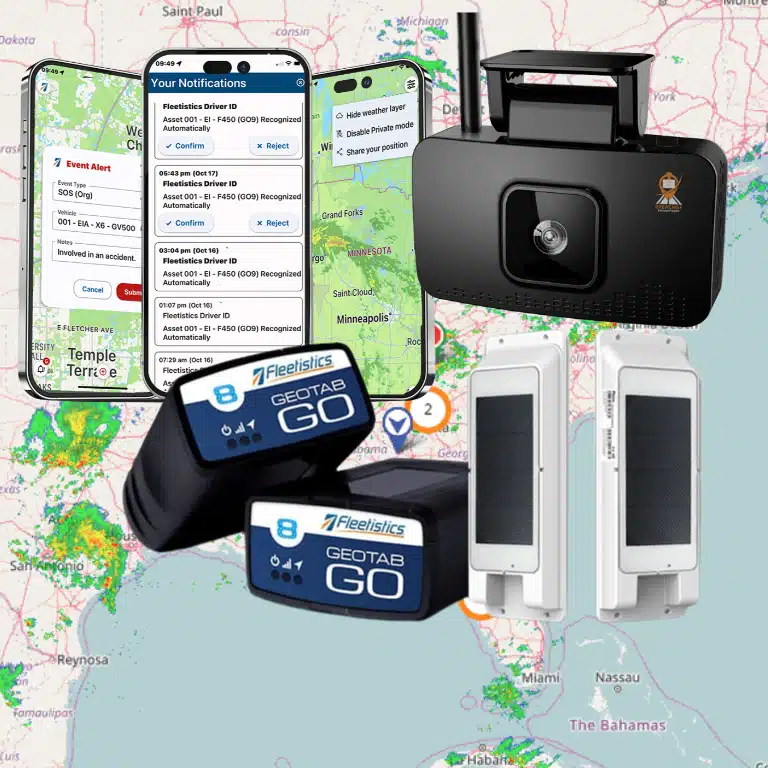

Fleet managers often lose hours manually checking vehicle locations or delivery times. Geofencing automates this by drawing invisible boundaries on a map. These fences alert you when a truck enters a site.
Geofencing for fleet management is a location-based technology that uses Global Positioning Systems (GPS) to build virtual geographic boundaries in software. These digital fences allow managers to monitor vehicle movement and trigger automated responses when a truck enters or leaves a set area. This tool is vital for better routes, asset protection, and maintenance planning because it replaces manual check-ins with reliable data. According to the DOT/FHWA, geofencing helps agencies collect traffic data and send travel alerts to specific locations. High-definition GPS ensures that these triggers fire with precision. By automating delivery logs and site arrivals, businesses can reduce fuel costs, improve service levels, and keep their drivers safe on every trip.
You might wonder how software can track a vehicle with such high accuracy. Our fleet GPS tracking for business guide covers the broad view, but here we focus on virtual zones. We begin with What Is Geofencing? (Plain-English Definition) as the path begins with.
Geofencing For Fleet Management: What Is Geofencing? (Plain-English Definition)
Geofencing is a tracking tool that builds digital borders on a map. In fleet work, these borders mark real spots like a job site or a yard. You use software to draw these lines around an area. When a truck with a GPS unit crosses one of these lines, the system sends a note or starts a task. This tool helps you track where your trucks go without having to watch a map all day. Using geofencing for fleet management makes it easy to see when work starts and ends.
Creating map zones with GPS
A geofence acts like a hidden fence that only a computer can see. The Federal Highway Administration says that geofencing uses GPS to build these digital map zones in a software tool. Most fleet bosses use two main shapes for these zones. A circle zone is a simple round area. A polygon zone lets you draw a custom shape to match the exact edges of a lot or a yard. These custom shapes work well in busy cities where you need to be very exact.
Setting up these zones is the first step to run your fleet on its own. You can set the tool to act when a driver hits or leaves a zone. For instance, the software can log the time a driver gets to a site. It can also tell you if a van leaves a yard after hours. By using these maps, you can see how your fleet moves in real time without any lag.
Why geofence tools matter for your fleet
This tool is more than just a map trick. It is a big part of any fleet GPS tracking for business guide because it saves you time. You do not have to check logs or call drivers to know their spot. The system does the work for you by tracking when trucks enter and leave zones. This makes it much easier to manage a big team across many states or cities.
Geofencing is also vital for keeping your gear safe and your paths fast. It helps with finding the best routes, guarding assets, and planning for repairs. If a machine moves out of a safe zone, you get a text right away. You can also use zones to track how much time a truck spends at a shop. These tools help you run a lean and safe fleet every single day.
How Fleet Geofencing Works: Zones, Alerts, and Automation
Fleet geofencing works by combining GPS satellite data with software boundaries to track vehicle movement. The system uses Global Positioning Systems to create a virtual geographic boundary within your tracking software. This technology lets you visualize geofence boundaries on tracking maps for clear site oversight.
GPS Tracking and Precise Zones
The process starts when a vehicle device gets a signal from GPS satellites. High-definition GPS is needed to ensure the software knows the exact location of the truck or van at all times. This high-level precision is vital for geofence triggering and alert accuracy. Without a clear signal, the software might miss a boundary cross or send a false alert.
Users can set up these zones as simple circles or complex shapes around specific job sites, yards, or fuel stations. The software checks the current vehicle spot against these pre-defined zones. When a match occurs, the system logs the event with a time stamp and location data.
| Zone Type | Best For | Typical Radius | Common Alert |
|---|---|---|---|
| Circular | Customer sites, fuel stations | 50 – 200 ft | Arrival / departure log |
| Polygonal | Large yards, warehouses, depots | Custom shape | After-hours movement |
| Corridor | Route compliance | Variable width | Driver left planned path |
| Geotag | Asset theft prevention | Point-based | Unauthorized move alert |
Automated Rules and Trigger Events
Automated rules are the heart of automating daily tasks with geofencing for your fleet. The system can trigger an automated response when a vehicle enters or leaves a zone. You can set rules for speed, idling, or after-hours use within these specific areas.
A rules engine supports both standard and custom rules to fit your business needs. For example, a rule might send an email to a manager if a truck leaves a depot before a set time. These triggers make geofencing fundamental for route optimization, asset protection, and maintenance scheduling. The goal is to turn location data into direct action without manual checks.
How does geofencing work?
Geofencing works by setting a virtual fence around a real-world area using software and GPS. When a GPS-tracked vehicle crosses that virtual line, it sends a signal to the fleet management system. This event can then fire off alerts, start timers, or log data for later reports. This helps you track arrivals and departures automatically to save time and reduce errors.
5 Practical Use Cases for Fleet Geofences
Using geofencing for fleet management allows you to turn map data into automatic actions. These virtual boundaries help you track assets and manage work without manual check-ins. Here are five practical ways fleet managers use this technology to improve daily operations.
Automate delivery and service logs
You can use geofencing to track when drivers arrive at customer sites. The system logs the entry time and sends a message to the client or home office. This automated delivery management reduces costs and cuts down on manual paperwork. It also provides clear proof of service if a billing dispute happens later.
Protect vehicles and expensive equipment
Geofences act as a digital lock for your yard or job sites. If a truck or piece of gear moves outside a set zone during off-hours, you get an instant alert. This type of asset protection is a core part of a GPS equipment tracking guide for any secure fleet. Fast alerts help you find stolen items before they are gone for good.
Monitor driver route compliance
Sticking to planned paths keeps your fuel costs low and your schedules on time. You can set up corridor zones along your main routes. If a driver leaves that path, the system flags the event for review. This helps you find where route optimization is failing and where you might need to coach your team for better efficiency.
Track time at job sites
Manual time cards are often slow and full of errors. Geofencing logs the exact minute a worker enters and leaves a work zone. This data flows into your payroll system to make sure pay is fair and accurate. It also helps you see which jobs take longer than others so you can bid better on future projects.
Manage vehicle maintenance visits
You can set up geofences around your service shops or dealer lots. When a vehicle enters the zone, the system can mark a repair task as in progress. Once it leaves, the task can close out and update the main maintenance scheduling record. This ensures your service history stays up to date without any extra data entry from your staff.
- Delivery Verification: Triggers a proof-of-delivery notice when a truck enters a customer site to speed up billing.
- Theft Prevention: Sends an alert to your phone the second equipment leaves a yard or job site without a plan.
- Route Compliance: Keeps drivers on the best paths to save fuel and meet tight delivery times for clients.
- Time Tracking: Records when people start and stop work at specific zones to make payroll fast and simple.
- Maintenance Alerts: Updates your shop records when a vehicle pulls in for service or leaves after a repair is done.
How to Set Up Geofences in the Geotab/Fleetistics Platform
Setting up geofences is a key part of geofencing for fleet management. Fleetistics has been a Gold Reseller for Geotab for over 20 years. We help you use this tool to track and manage your fleet. Our platform makes it easy to build virtual zones in software using GPS. This process helps you track when vehicles enter or leave a spot.
Log In and Find the Map
First, log in to your platform to start. The system uses a web dashboard that works on most devices. Once you are in, go to the map view. This map shows all your vehicles in real-time. You can zoom in on any area to start building your zone. Finding the right spot on the map is the first step to better fleet management geofencing solutions.
Draw Your Zone Boundaries
You can draw a zone in two ways. You can choose a simple circle for small spots like a fuel pump. For complex shapes, use the polygon tool to trace around a whole yard or job site. The tool is very flexible for any shape you need. Large fleets can even import up to 200,000 zones at once from a file. This saves time when you have many spots to track.
Set Your Rules and Triggers
- Pick the type of event you want to track, like entering or leaving a zone.
- Use the rules engine to set triggers for things like speed or time spent in a zone.
- Choose how you want to get alerts, such as by email or SMS text.
- Set up automated actions using free APIs to send data to other software.
- Save your zone to start tracking all vehicle moves in that area.
Check Your Alerts and Data
After you save a zone, the rules engine starts working right away. It can trigger automated responses in the software as soon as a vehicle moves. This helps you know when work starts and ends each day. You can also see these geofence boundaries on maps to see where your team is. Use this data to save money and keep your assets safe every day.
What Is the Best Geofence Setup for a Delivery Fleet?
Setting up the right geofence zones helps your delivery team work faster and stay safe. A smart layout makes sure you get the right data without too many false alerts. Using geofencing for fleet management lets you see when drivers arrive and leave key spots automatically. These virtual lines use GPS to trigger a response in the software as soon as a vehicle enters the area.
Choosing the Right Zone Shape and Size
For most customer sites, a circular zone with a radius of 50 to 200 feet works best. This size is big enough to catch the vehicle GPS signal but small enough to be precise. If a stop has a complex layout or sits near a busy road, you should use a polygon shape. Polygons let you draw exact lines around a lot or a loading dock to avoid catching passing traffic. High-definition GPS tools from Fleetistics help ensure these boundaries trigger alerts with high accuracy.
Setting Up Alerts for the Best Results
You should set up three main types of alerts for your delivery routes. First, use entry and exit alerts to log arrival times for proof of delivery. Second, set up alerts based on time to find drivers who spend too long at one stop. This data helps you find delays in your process. Third, use alerts for extra idling within a zone to lower fuel waste. Simple tracking systems help reduce costs and improve service by watching these key events in real time.
Improving Multi-Stop Routes
A delivery fleet often has many stops in one day. You can import up to 200,000 zones into the Fleetistics system to cover every stop on your map. This scale allows you to track a full route from start to finish without manual data entry. By linking these zones to your rules engine, you can automate daily tasks and keep your fleet on schedule. This setup is a key part of any fleet management geofencing plan for delivery teams.
Frequently Asked Questions
Where can I draw a geofence on a map?
You can place a virtual boundary around any physical spot on a map. Common choices include job sites, customer offices, warehouses, or even a driver’s home. Once you set the area, the software monitors when vehicles cross that line. This makes it easy to track when work begins or when an asset leaves a safe zone. You can use these zones to manage almost any location your fleet visits during the day.
How many geofences can I create in one system?
The number of zones you can create depends on your software provider. Some basic systems limit you to a few dozen areas. However, professional platforms like Fleetistics support importing up to 200,000 geofenced zones at once. This high limit allows large businesses to track every customer site and fuel station. It ensures you never run out of space in your tracking system, even with a massive fleet.
What shapes can a geofence be?
Most tracking tools let you draw two main types of shapes. Circular zones are the easiest to set up and work well for simple point-to-point tracking. Polygon zones allow you to draw custom shapes that match the exact lines of a building or a complex yard. Using custom shapes helps prevent false alerts. It ensures the system only triggers when a vehicle is truly inside the specific area you want to monitor.
How accurate is GPS geofencing for vehicle tracking?
Accuracy depends on the quality of the GPS hardware and the frequency of data updates. According to the Federal Highway Administration, geofencing uses GPS coordinates to create virtual geographic boundaries in software. For the best results, you should use high-definition GPS devices. These tools provide real-time tracking with high precision. This ensures that alerts trigger exactly when a driver enters a site rather than minutes later or miles away.
Can geofencing data integrate with other business apps?
Yes, modern fleet platforms are built to share data with the other tools you already use. Geofencing alerts can send live data to your payroll, dispatch, or maintenance software using free APIs. This creates an open ecosystem where your location data helps automate daily tasks. Instead of manual data entry, your system can automatically log arrival times. It can update customer status as soon as a truck enters a pre-set boundary.
Ready to set up geofencing for your fleet?
Running your fleet without clear zones leads to high costs from missed stops and late trips. You lose money when a driver takes a wrong path or lets a truck sit idle for too long. Setting up these tools now puts you back in charge. It stops small leaks before they grow into big losses for your firm. You will see a clear change in how your team works as soon as your first alerts go live. Waiting to act only lets those daily costs pile up while your rivals use better tech to get ahead. You can save time and keep your trucks safe with just a few simple steps.
Ready to get a free consultation? Call (855) 300-0527 to speak with a consultant about setting up geofencing for your fleet.