

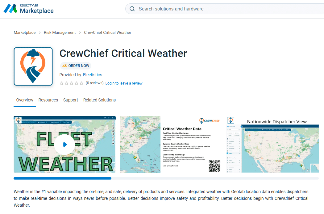
Critical Weather
38% of fleet manager report weather is the #1 safety blind spot 855.300.0527Geotab Order nowThe Cost of Weather
Weather doesn’t just delay deliveries—it costs fleets millions every year in accidents, fuel waste, insurance hikes, and downtime. Every storm, fog bank, or patch of black ice increases the risk of costly incidents that could have been avoided. Our fleet-focused weather intelligence platform delivers hyper-local, driver alerts and long-range forecasts—helping you reroute safely, optimize schedules, and protect your drivers before weather becomes a problem. Join leading fleets that are reducing weather-related incidents by up to 30%, cutting fuel costs, and turning unpredictable conditions into a competitive advantage. Discover how a small monthly investment can deliver massive safety and financial returns.
Safety is #1
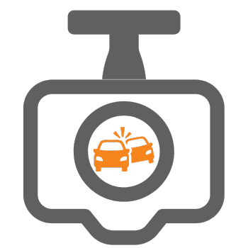
In the transportation industry, safety isn’t just a priority—it’s the foundation of every successful fleet. Weather contributes to approximately 22–25% of all commercial vehicle crashes (per NHTSA and FMCSA data), resulting in thousands of preventable incidents each year.
Real-time, hyper-local weather intelligence lets you see hazardous conditions exactly where they matter: on your planned routes. With precise data on black ice, heavy rain, high winds, or fog, fleet managers can proactively reroute vehicles, while drivers and dispatchers make smarter, safer decisions—delaying departures or adjusting schedules when conditions demand it.
Fleets using advanced weather routing have reduced weather-related incidents by up to 30%, dramatically lowering liability exposure and ensuring drivers return home safely every day. Make safety your competitive edge with weather insights designed specifically for fleets.
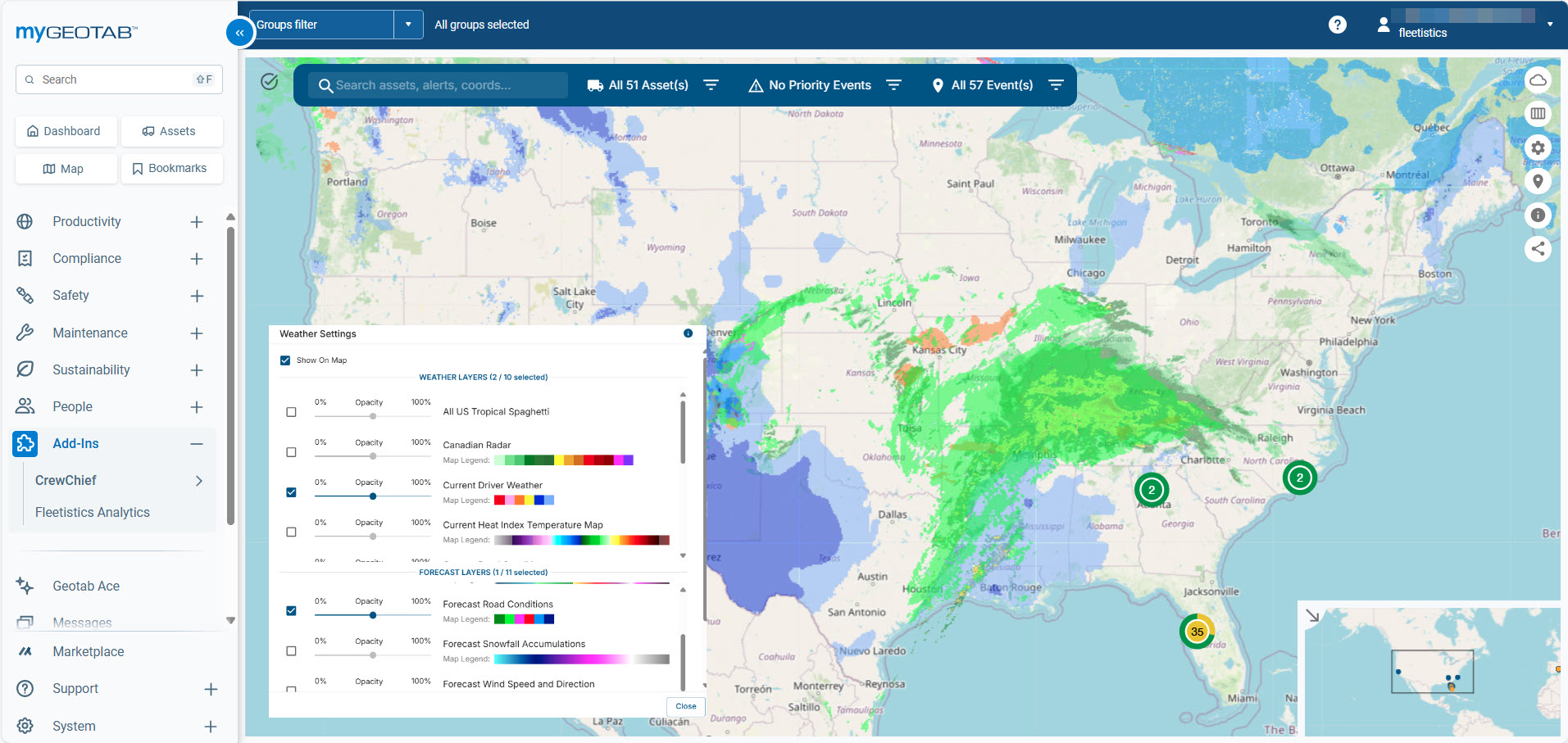

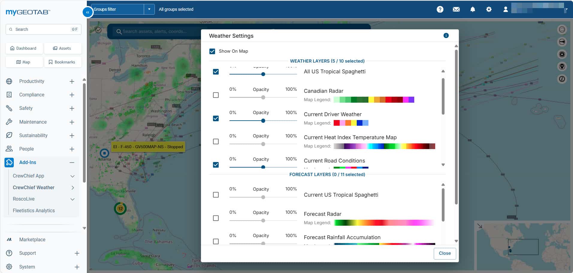
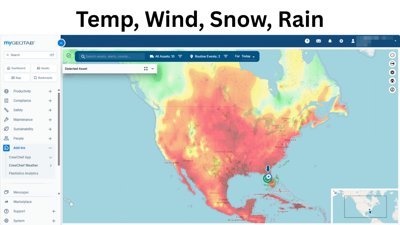
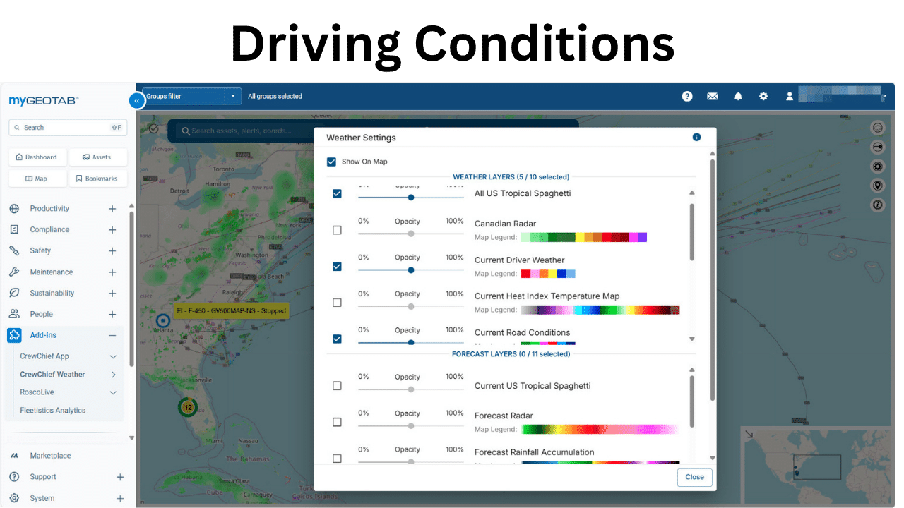
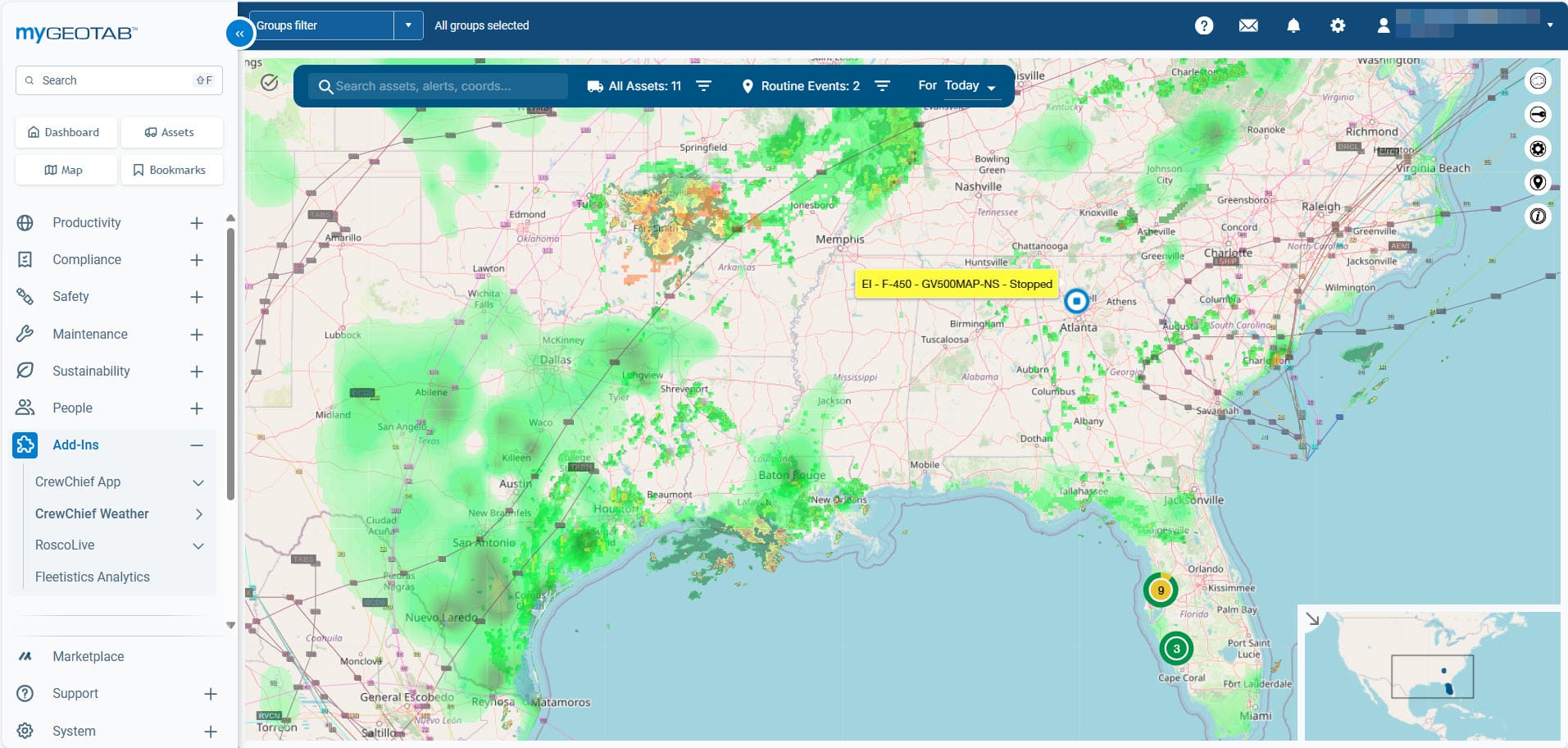
Current & Forecast Weather
Avoid hazardous road conditions by routing around heavy snowfall or severe rains to optimize routes.
Avoid long traffic delays protect your HOS driving hours, reduce fuel, and reduce wages.
Choose Multiple Weather Layers
Geotab Marketplace Order Now
21% of vehicle crashes are weather-related
1 in 5 deliveries are delayed by unexpected weather events
38% of fleet managers say weather is their #1 safety blind spot
Increased Transparency and Communication
Real-time fleet sharing fosters trust and improves customer satisfaction.
Improved Efficiency and Productivity
One-click mobile access allows for faster response times and better field service management.
Enhanced Safety
Weather radar helps you avoid hazardous conditions and protect your drivers and assets.
Reduced Costs
MyFleetView eliminates the need for expensive automated emailing systems and standalone weather services.
Historic Data
Analyze past fleet activity and weather patterns.
Reporting and Alerts
Generate customized reports and receive alerts about important events.
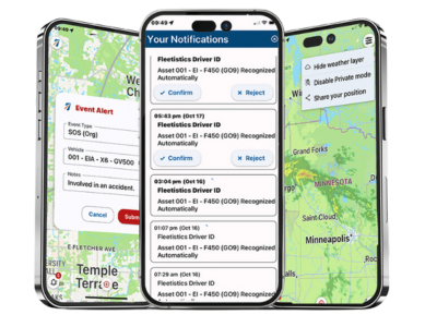
Share a Live Map, With Weather Map Intelligence
Need to coordinate with contractors, emergency response teams, or university departments? Our map-sharing feature allows you to create temporary, secure, live maps with selected vehicles and live weather data, without sharing full access to your platform.
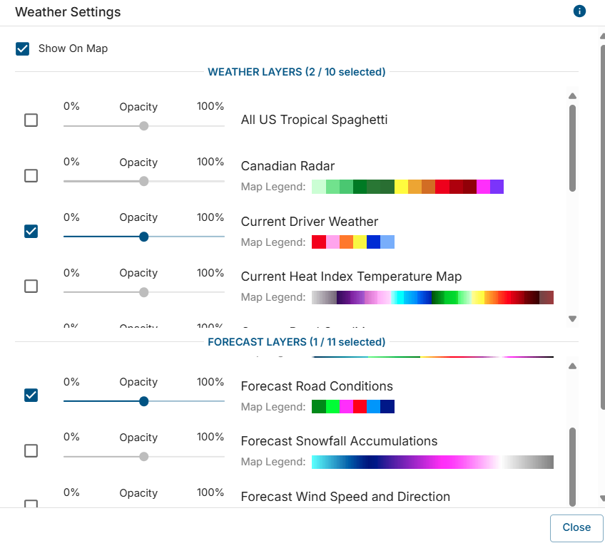
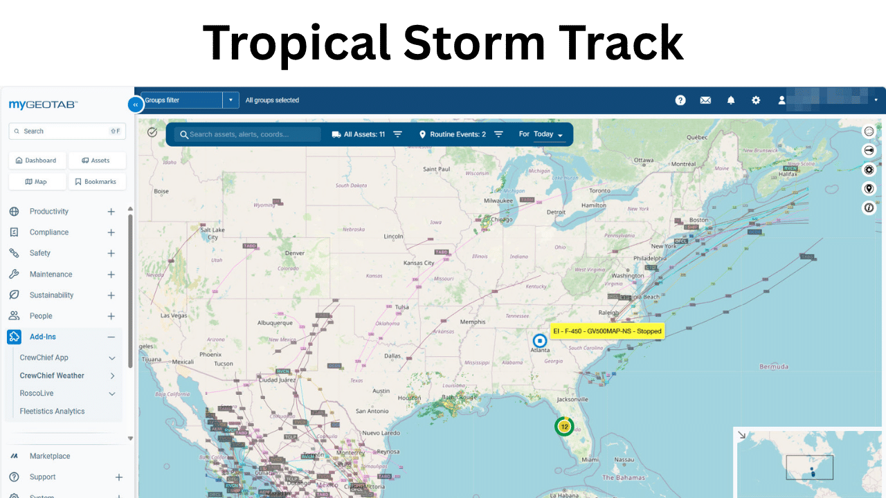
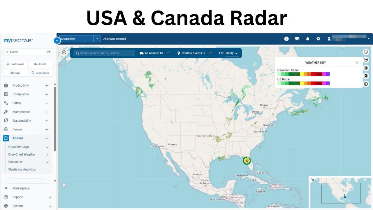
Current Weather Layers
- Tropical spaghetti
- Canadian Radar
- US Radar
- Driver conditions
- Heat index temperature
- Road conditions
- Roadway threats
- Temperature
- Wind chill
- Wind speed
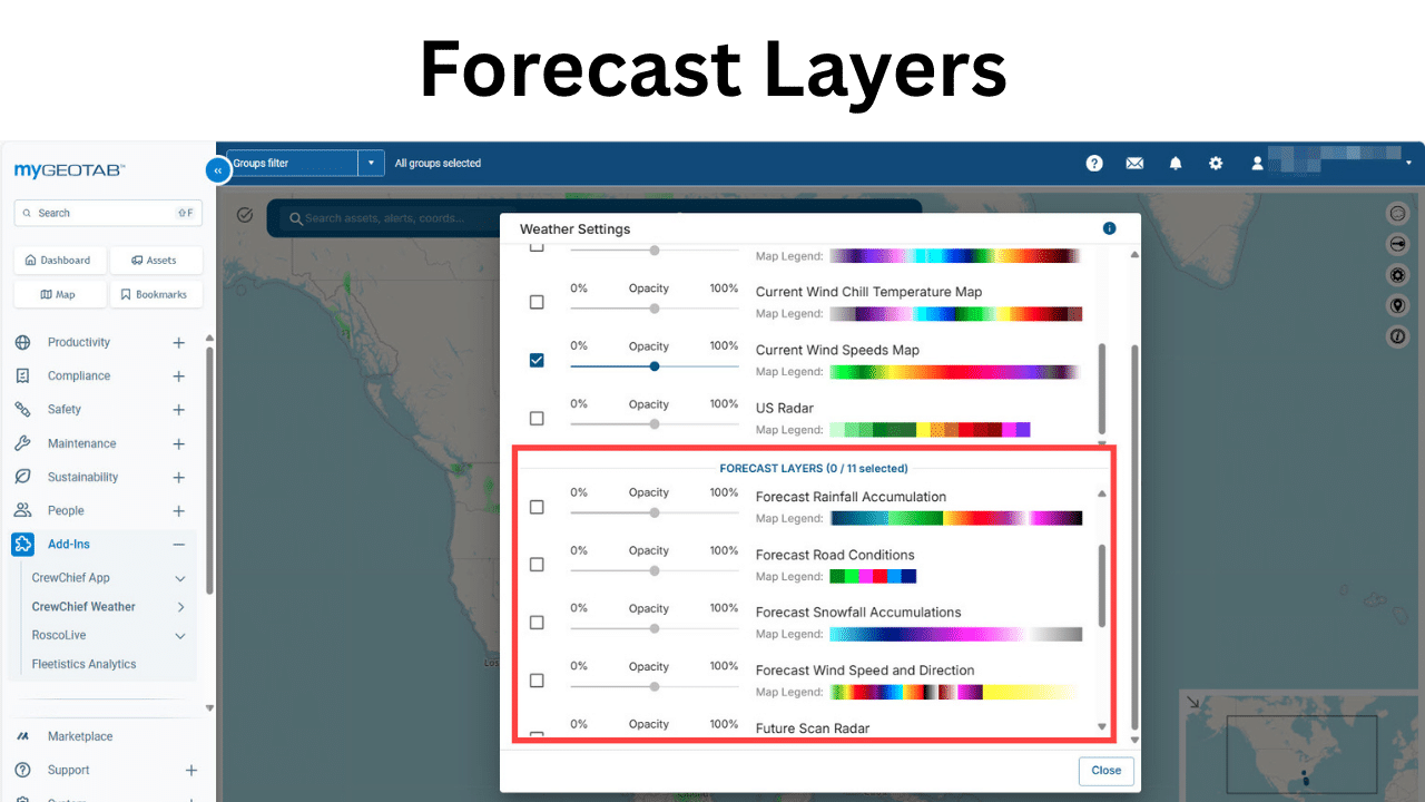
Forecast Weather data
- Future radar
- Rainfall accumulation
- Road conditions
- Wind speed and direction
- Storm probability 1, 2, 3 days
CrewChief Mobile App
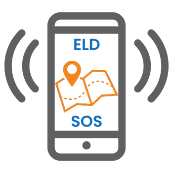
Learn about our priority alert and tracking mobile app for lone workers, man-down, and priority alerts.