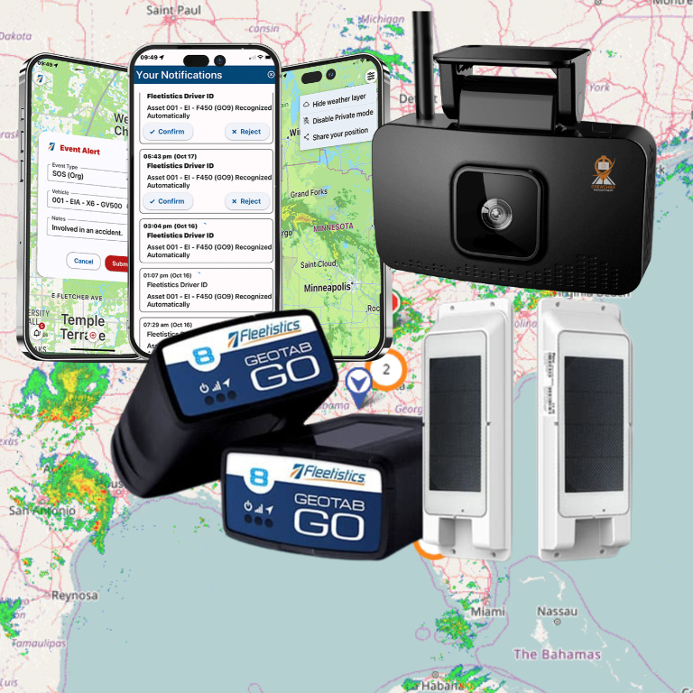

Knowing where a vehicle is matters, but fleet managers usually need more than a moving dot on a map. They need timely information about vehicle status, driver activity, routes and service needs, including fleet management visibility, so they can act before a small issue becomes a missed delivery, safety problem, or compliance risk.
Schedule a free consultation with a Fleetistics fleet consultant to see how automatic vehicle location fits your operation.
An automatic vehicle locator system for fleets combines GPS or GNSS positioning, cellular or satellite connectivity, and fleet software to determine and transmit vehicle location and operational data in near real time.
That combination turns location data into practical fleet intelligence. You can use it to improve dispatching, support maintenance planning, investigate incidents, and coordinate vehicles working across wide or difficult-to-monitor areas. It also pairs naturally with a fleet safety solution and related safety tools, including AI dashcam and fleet driver safety technology, when you need a fuller view of what happened on the road.
First, it helps to separate AVL from basic GPS tracking by looking at what the system measures, transmits, and connects to your daily fleet operations.
What Is an Automatic Vehicle Locator System for Fleets?
An automatic vehicle locator system for fleets is a fleet management tool that automatically determines and transmits a vehicle’s location in real time. Fleet managers use the resulting information to see where vehicles are, understand their operating status, and make faster decisions about daily work. The U.S. Department of Transportation describes AVL as a way to monitor fleet-vehicle locations at any given time.
Unlike a standalone navigation device, an AVL solution connects vehicle hardware, communications, and fleet software. A small piece of GPS tracking hardware installed in the vehicle gathers positioning and operational data and then sends that information to a platform where authorized users can view it on a map or use it for reporting. The Oklahoma Office of Management and Enterprise Services explains that these devices are also known as automatic vehicle locators.
What does an AVL system track?
The exact data depends on the device, sensors, and software configuration. A practical system may give your team visibility into:
- Vehicle location: Current position, travel history, and movement between stops.
- Vehicle status: Whether a vehicle is moving, stopped, idling, or otherwise active. Many AVL systems can indicate the status of each vehicle, not just its location, according to the U.S. Department of Transportation.
- Route activity: Progress against planned routes, service areas, or assigned work.
- Operational patterns: Data that can support maintenance scheduling, route optimization, safety reviews, and compliance programs.
- Fleet history: Records that help managers investigate delays, confirm service activity, and compare performance over time.
AVL is used across trucking, transit, emergency management, and municipal public works. For a commercial fleet, the value is not simply watching dots move across a screen. It is turning location and vehicle data into a clearer operating picture, so you can assign work, respond to exceptions, and evaluate fleet performance with evidence.
How AVL Systems Work: GPS, Cellular, and Mapping Technology
An AVL setup turns a vehicle’s movement into information your fleet team can use. The process has three connected stages: determine position, transmit data, and interpret it through fleet software.

-
1. The receiver determines the vehicle’s position
A small tracking device installed in the vehicle uses a GNSS/GPS receiver to collect signals from positioning satellites. The receiver calculates where the vehicle is and provides the location data that forms the foundation of the system. The U.S. Department of Transportation describes AVL as a fleet management tool that lets managers monitor vehicle locations in real time. Read the U.S. DOT’s AVL overview.
-
2. The device transmits the data
After the device collects positioning information, it sends that data to a central server over a cellular network. In areas where cellular coverage is limited, a satellite network may provide the communications path. The device can also collect information from the vehicle and connected sensors, allowing the system to report more than a point on a map. Oklahoma’s fleet guidance identifies these installed devices as automatic vehicle locators and describes their role in collecting telematics data. See Oklahoma’s AVL guidance.
-
3. Software turns raw data into fleet intelligence
Fleet management software receives the incoming data, places the vehicle on digital maps, and organizes it into useful telematics. Depending on the equipment and configuration, you may see current location, route progress, speed, and vehicle status in one interface. The U.S. DOT notes that many AVL systems can indicate the status of each vehicle, not just its location. That context helps dispatchers understand what is happening now and helps managers evaluate routes, maintenance needs, safety, and productivity over time.
The result is a connected loop: positioning identifies where the vehicle is, communications deliver the information, and software makes it actionable. The right configuration depends on your operating area, vehicle types, coverage requirements, and the decisions your team needs to make.
AVL vs Standard GPS Tracking: What’s the Difference?
Standard GPS answers one question: Where is the vehicle? An AVL system builds on that position fix by transmitting data through cellular or satellite connectivity and organizing it in fleet software. The result is a broader view of vehicle location, operating status, driving activity, routes, and maintenance needs.
That distinction matters when you are managing more than a map. The U.S. Department of Transportation describes an automatic vehicle location system as a fleet management tool that lets managers monitor vehicle locations in real time. It also notes that many systems indicate the status of each vehicle, moving AVL beyond a simple point on a screen. Read the DOT overview of AVL systems.
| Capability | Standard GPS tracking | AVL system |
|---|---|---|
| Shows location | Provides a vehicle position fix or map location. | Displays current and historical locations in fleet software. |
| Transmits data | May provide location data without a broader telematics connection. | Uses cellular or satellite communications to send vehicle data to the platform. |
| Vehicle status | Usually limited to location unless additional hardware is connected. | Can show operating status and other available vehicle conditions. |
| Driving behavior | May not capture speed, harsh events, idling, or related activity. | Can combine location with speed and driving-event data for fleet oversight. |
| Route and maintenance insights | Does not typically turn location alone into operational recommendations. | Supports route optimization and proactive maintenance scheduling when the required data and software are configured. |
In practical terms, GPS is the positioning layer. AVL is the connected system that turns positioning and vehicle data into decisions. Government fleet guidance describes AVL devices as small tracking units that collect data for telematics, while that data can support route optimization and maintenance scheduling. If you only need to locate an asset, basic GPS may be enough. If you need to understand how the fleet is operating and what action to take next, an AVL platform provides the stronger foundation.
Get a free fleet tracking assessment to compare GPS and AVL options against your actual routes and vehicles.
When Does Your Fleet Need an AVL System? (Triggers and Use Cases)
You may be ready for AVL when dispatchers, supervisors, or customers need answers that a paper log or occasional phone call cannot provide. The strongest use case is not simply seeing a vehicle on a map. It is turning location and vehicle-status data into faster decisions, clearer accountability, and more consistent service.
- You need real-time visibility. If vehicles cover a wide territory, dispatchers can see which unit is closest, identify delays, and give customers more accurate arrival updates. This is especially useful when schedules change throughout the day.
- Compliance and accountability are becoming difficult. Location history and vehicle status can help you document routes, investigate exceptions, and verify that work was completed. Managers can also use the data to support safer driving expectations and operational policies.
- Routes are costing more time or fuel than expected. When teams repeat inefficient routes, make unnecessary stops, or lack visibility into field conditions, AVL data can reveal where route planning needs attention. Government and commercial fleets use these insights to improve operations, including maintenance scheduling and route optimization according to Oklahoma’s fleet management guidance.
- Maintenance is reactive. A system that provides vehicle and usage information gives managers a stronger basis for scheduling service before avoidable downtime disrupts the operation.
- Driver behavior needs coaching. If speeding, harsh driving, unauthorized stops, or excessive idling are recurring concerns, objective trip data gives supervisors a practical starting point for coaching.
- Assets are exposed to theft or misuse. Location history can support faster recovery efforts and help establish when and where an asset moved outside its expected use.
- Your public works operation is planning a larger program. AVL is widely used in trucking, transit, emergency management, and municipal public works, including snow removal. The U.S. Department of Transportation identifies it as a valuable tool for maintenance and operations activities in these environments. Public agencies should also evaluate eligible budgets, cooperative purchasing options, and grants before selecting a system.
You are ready to evaluate an automatic vehicle locator system for fleets when reliable field visibility can improve a measurable business, safety, service, or public-works outcome.
How Fleetistics Implements AVL for Government and Commercial Fleets
Fleetistics starts with the fleet’s operating environment, not a preselected device or software package. A municipal public works department, regional transit operation, and commercial service fleet may all need location visibility. But their reporting, compliance, vehicle types, and dispatch workflows can be very different.
The implementation typically combines small, installed AVL telematics devices with connectivity and fleet software. Oklahoma’s fleet guidance describes these devices as automatic vehicle locators that collect data to support productivity and performance management. That data can inform route optimization, maintenance scheduling, safety programs, compliance, and fuel-efficiency decisions. See the source guidance on AVL telematics devices.
Match the platform to the operation
Fleetistics uses a modular approach so you can begin with the capabilities that matter most, then add functionality as the operation develops. That may include real-time location and vehicle status, maintenance workflows, driver behavior monitoring, compliance tools, or integrations with existing business systems. The goal is a practical operating system for the fleet, not a dashboard filled with unused features.
For government fleets, Sourcewell cooperative purchasing can help eligible organizations evaluate an established procurement path. For commercial fleets, the same consultative process focuses on measurable outcomes, such as reduced route waste, better maintenance timing, improved asset utilization, and stronger visibility across dispersed teams.
Advocate for the fleet, not the manufacturer
As a Geotab Reseller Partner Vocational Elite, Fleetistics gives customers access to an open ecosystem, free APIs, and more than 300 marketplace integrations. The relationship matters because Fleetistics advocates for your requirements and helps translate technology into an implementation plan. Customers work with a partner who understands the fleet rather than being left to navigate manufacturer decisions alone. To understand what telematics data can do for your operation, start with what telematics is and how it works.
That support extends beyond deployment. Fleetistics has served fleets since 2001 and provides 24/7 support across its solutions. You can explore automatic vehicle location tracking or review broader fleet tracking software and telematics solutions. If safety is part of the implementation, connect AVL data with an AI dashcam and fleet safety strategy for a more complete view of vehicle activity and driver risk.
Talk to a Fleetistics consultant about an automatic vehicle locator system for fleets and get a recommendation matched to your vehicles, routes, and reporting needs.
Frequently Asked Questions
What is an automatic vehicle locator system?
An automatic vehicle locator (AVL) system is a fleet management tool that lets you monitor vehicle locations in real time. A device installed in each vehicle collects location and operational data, then sends it to fleet software for mapping, alerts, reporting, and analysis. The U.S. Department of Transportation describes AVL as a way for fleet managers to monitor vehicle location at any given time. Source: U.S. DOT
How does an AVL system work?
The installed device determines the vehicle’s position through GPS or another satellite positioning system. Cellular or satellite communications transmit that information to a cloud platform, where mapping and telematics software turns it into live location views, history, alerts, and reports. Depending on the equipment, the system can also report vehicle status and other data. Source: U.S. DOT
What data does an AVL system transmit from a vehicle?
At a minimum, an AVL system transmits location and time information. More capable devices can collect vehicle status, mileage, diagnostics, driver behavior, and other operational data, depending on the vehicle and configuration. That broader data set supports route optimization, maintenance scheduling, safety monitoring, and compliance work. Source: Oklahoma OMES
Can AVL systems help with theft recovery?
Yes. Real-time location visibility can help a fleet identify where a vehicle or asset is operating and provide location history for an investigation. Recovery results depend on the device remaining powered and connected, along with prompt coordination with law enforcement. AVL is one part of a broader fleet security plan, not a guarantee of recovery.
Ready to Put Fleet Location Data to Work?
A clearer view of vehicle location and status can help you choose tracking workflows that fit your operation, routes, and service goals. To schedule a free consultation with a fleet management consultant, reach out to Fleetistics. We can discuss your fleet’s needs and the next practical step without forcing a platform that does not fit.