Zones + Basic GPS System Data – Location, Date, & Time
Our goal is to assist our readers with using GPS tracking system data, specifically zones and geofences, for routine operations, consequently achieving a higher return on investment. This new series is contributed by Darryl Arnold, our Director of Product Development.
Business owners are generally aware of GPS tracking device’s ability to report a location as well as the date and time. Almost every vehicle tracking system provides much more than just location data. Our focus is on using just the GPS location, time, and date provided by the GPS tracking devices to automate some of your standard business tasks y using zones or geofences.
Transcript of Eron & Darryl Discuss Using Zones
Click Here to View
Hi everybody, Eron and Darryl with Fleetistics and today we’re going to be talking about zones and geofences and whatever you want to call them, but the little polygons to go around specific areas of interest to you, and we’re going to be talking about not just you know the concept of a zone, but really what are the practical applications of zones as they relate to business and business operations. So Darryl, let’s start by simply defining what a zone or a geofence is.
A zone is a mechanism that a gps system uses to define a location on the map. Everything from a building, you can put a zone around an entire state, you can put it around a county, a municipal region, but basically what you’re doing is using a zone to to tell the gps system that this is a region or a place that that you need information about.
And what would be an example of each one of those things? So you talk about a state level county level and a building or a piece of property.
Generally when you’re talking about a building most customers the first thing that they do for zones is to create a zone around their building or the location of where their vehicles are. When you have that zone you can use it to receive notifications or keep track of the times that a vehicle leaves or a time that a vehicle returns. It also allows you to keep track of the amount of time that a vehicle spends at an office when you’re talking about a zone around a town or or a county the primary use for that is to make sure that a vehicle or a fleet of vehicles remain inside of an area – an operating area. For example if you have vehicles that that are responsible for you know servicing a specific territory, a zone allows you to make sure that that vehicle is remaining in that territory. When you’re talking about states the same thing applies as a town or a county you know an operating area, but what it also does is allow you to keep track of the amount of time that’s being spent in the state which can also assist with with IFTA and and some of the the fuel tax regulation.
Certainly the taxes for assets utilized in one state may be very different than taxes for utilization in a different state so knowing the number of miles that you drive in each state is certainly important to that. Two things to come to mind from customers that I can think of one is was a local county here in Florida that basically provided emergency services right and when they went outside the county they wanted to track when they were outside the county or their jurisdiction so they could bill whoever they were going to service based on the amount of time I guess and resources you know that were utilized outside of their jurisdiction so it was important to know when the fire trucks left their area and where they were going to and how long they were at the fire location or you know whatever the emergency location was. So that was a really good example and the other one that comes to mind is we have a nationwide customer that has over 300 locations and somehow they manage to ship vehicles between branches you know they do like horse trading of vehicles so corporate has a hard time keeping track of who’s got what vehicles and then when it comes to dispatching and knowing you know perhaps what resources are on different vehicles it makes that harder because they’re not returning to the expected location so by putting a zone around each branch and then having that vehicle uh set up to notify if it if it doesn’t return to that branch it allows more insight and oversight over where these vehicles are if they’re not where corporate thinks they are. So just two applications there for zones. Obviously we’ve got lots of others with customers and things like that. With zones how many or what shapes can zones be?
It all depends on the gps system you’re working with but today most gps systems allow for essentially an unlimited number of points. I know that our primary system allows for literally an unlimited number of points the other two systems state that they do but in reality you know once you get over a certain level you know it’s questionable on the performance. Something else I’d like to say from an application that we were talking about from you know putting a zone around a building. You know many of our customers actually do their billing based on the amount of time that a vehicle spends on site and you know it if you can put a zone around each one of your customers, the system can provide a report at the end of the day or at the end of the week of the actual start time you know when the vehicle entered the zone or arrived at the location, how much time it’s spending inside that zone, and also lets you know when it leaves. You know so that this is actual real-time information that that a driver doesn’t have to spend their their resources or time keeping track of and then reporting to the accounting department. The information goes directly to accounting and you can’t get more accurate in keeping track of time on site than a gps system.
Yeah one of the very applicable examples of that would be landscape management. You’re talking about the large commercial companies that take care of entire subdivisions and when you go into that situation you’re billing you’re pricing the job based on how many hours, man hours you think it’s going to take to be able to manage that property and care for that property over the course of a year. Well, if you put a zone around that entire property and every three months you’re evaluating the number of man hours actually spent inside maintaining that property you can get a very accurate picture of what it actually takes to do that job. And you may have in your contract where you can you can increase billing or you decrease billing based on the actual number of man hours required to maintain an area, so it’s going to give you the ability to not get burned by underselling a job and it’s going to help the customer by not getting oversold when it takes far fewer hours to to do a job and that over time builds a database of accurate information for you to do a better job actually pricing communities and certain types of jobs based on the the footprint and the type of work that’s going on inside that zone.
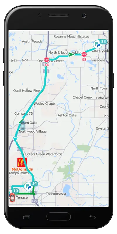
Definitely, I mean we could go on all day about different applications in business for using zones but I’d like to throw out one more. We had a customer that was a security company and they were contracted by apartment buildings, condo associations to do drive-throughs you know at certain times of the day or do drive-throughs at varied times of the day to you know for just basically associated with the operations of the the complex, and they were continually having complaints from the you know the condo associations and the apartment building managers that the person wasn’t showing up or they weren’t on there on site long enough or they didn’t do… what we ended up doing was was putting a zone around the entire complex the entire property and at the end of the day the system actually sent an email to the the customer that outlined what time the the vehicle arrived, where the vehicle actually drove, with the you know the track you know through the gps system and when they exited. So it it provided accountability to the customer for the company without actually having to take any time, effort, or energy to you know to invest payroll into it or staff time or anything like that.
When do zones not work well? I can think of two scenarios but when do zones kind of run into trouble you know and they start to lose their accuracy or or you know functionality?
You got me on that one we got out of this I don’t know I can’t think of a situation that his own doesn’t work.
Yeah, I got started in the pest control business so a good example is typically in residential service industries where you may have multiple customers on the same block, right, and in the pest control business you might have customers that are right next door or across the street and what happens is the technician shows up and he parks in front of one house and he just walks to the others, right? So if you’re trying to track the uh the interaction and time spent with each one of those customers, if the vehicle is parked in front of one you’re not going to know what’s going on in the others because he’s not moving the vehicle into that particular zone. So you know the zones have to be based on where the vehicle is actually parking so if you have a large industrial complex and the vehicle is parking in the back but you missed you know you didn’t you didn’t include that in the zone that’s a problem. In residential areas if the vehicle parks in in front of customer A but services A, B, C, and D by foot, you’re not going to know the time spent A,B,C, and D. So you may have to draw a zone around all four of those customers to kind of associate the general time spent servicing all of them. So that was that was one example. The other example is kind of similar to that you know you get different businesses on different street corners and is it gas station A or gas station B? You know that type of thing zones can go down to you know we look at the accuracy of gps today I mean really you can go down to like a couple parking spaces and know where the vehicle is parking so when doing zones it’s important to be very accurate based on vehicle parking. When it comes to dealing with large numbers of zones you know talk about the process of importing zones so if you’re migrating or you have a customer database where you have addresses or more importantly latitude longitude what are some of the things that go into importing zones? What are some of the options available when importing zones, and how does that really help with the efficiency you know when we think about you know importing over 100 000 zones for one customer? You know obviously that’s a huge time saver being able to do that.
Definitely the you know the the act of importing a zone is is really creating zones based on information within a spreadsheet. It can be done based on an address a lat longitude latitude coordinates, and the the import zones are really not detailed in the sense they’re not drawn. So you know they don’t have a lot of points. They’re generally either a square or a circle, and you know that works when you’re dealing with the type of zones that you want to work with for you know for an import. An application like the the apartment building or the condo association it’s not going to work for that you really want to draw each zone individually because of the shape of the properties and wanting to keep specific track of that, but when you’re doing an import basically just throw it in in an excel spreadsheet. You just need the location. The location can either be a street address it can be the lat/long. Then you specify the shape of the zone whether it’s a square or a circle and then specify the radius that you want it to be. You always want to make sure that the zone is big enough. We’ve had situations where customers did not get the information they were looking for because the zone didn’t extend out into the road and the vehicle was parking in the road and the zone was small enough that it covered the building. The the vehicle never quite made it into the building or into the building parking lot. So you can list there another alternative for creating that type of file is to do an export from your accounting program. With your account with your customer list from an accounting program you can get a list of you know the customer name which you can use as the name of the zone. Then the the actual address, the city, the state and export it as a csv. Then you can edit the format of that csv in excel and then do your import from there. There’s a lot of different ways that that you can go about creating the zones from an automated perspective, but the most common is to get your customer list out of either a crm, you know a contact manager, or an accounting system.
Yeah and I think we have to manage people’s expectations with zones. You are not going to correctly zone 100 % of your customers, right? That’s highly, highly unlikely to happen unless you have very unique customer situations where the properties are spread out, like they’re not next to each other at all, and maybe they’re of such a size that if you create a 1000 meter zone that you know that you’re always going to be covering that entire customer location without any overlap, and the vehicles are always going to park inside that zone. Mostly, most of the customers we work with are going to maybe get 70 to 80 percent of the zones correctly imported and then you’re just going to have to manually adjust to get the other ones to you know be exactly where you want them to be. It’s important to understand that when you work with zones that the, the center point of the nearest zone is going to be what the vehicle data is associated with. So if you have two zones that overlap and the vehicle is parking in that overlap area it’s going to look at the two center points of the zones that were imported or created and say which one am I closer to and it’s going to then associate data with that particular zone. So that’s where you go in and you manually adjust those zones to spread them out or change the shape and then the accuracy of your information continues to climb. The other thing that I try to tell people is when you implement tracking technology and telematics it becomes part of your business process, right? When you onboard a new customer, are you also putting them into the gps system, creating their customer zone, and establishing whatever parameters you want as far as time and service and exceptions to be reported? And if you do that as part of like a checklist of every new customer then it becomes an easy process to maintain. If you try to do it once every six months it’s a bigger project every six months and you’re missing data along the way, so you know in Darryl’s articles, which this is a part of that series, you know how do you get this information into your business process and this is one of the ways by making it part of the customer onboarding experience and process internally. All right, what else do we need to know about zones Darryl?
Well there’s two really two types of zones and and it’s not a technical differentiation, it’s more a business use differentiation. When you’re dealing with a zone like Eron was talking about, a new customer coming on board and it’s a zone that you’re going to want in the system from here to eternity. You’re going to use it every day. You’re never going to edit it. You need to know exactly where you know the property lines are and things like that, that’s one appli… or one type of zone. Another type of zone is one that you have a list of places that your driver is going to go for the day. At the end of the day you’re never going to need these zones again, okay? You have the ability on many gps systems to specify a an expiration. So when you’ve got the temporary zone set up for situations where you know you you have a stop for that customer for today, you’re never going to hear from that customer again or that it’s going to be two or three years from now, you’re not going to want to store all of those zones at all times because you know first of all it just makes managing the zones for your staff a little bit more challenging because there’s so many in there, but you can set up an expiration time so that after a certain amount of time or after a certain time period in the day the zone deletes itself. When you’re dealing with those temporary zones they just don’t have to be as exact so just putting a circle over a location or a square over location will work pretty well, but when you’re working with with situations that that you’re going to be using the zone day in and day out you’re going to want to spend a little bit more time as Eron mentioned, and make sure that the property lines are covered, look at each zone individually, make sure that you know if they’re parking on the street is the street included in that? You know the there are two you know if you’re using a temporary zone that’s one approach if you’re using permanent zone as another approach.
A temporary zone example would be a like a cable installer right. They’re coming to hook up your internet and they’re only going to be there that one time. They’re probably not going to see you for five years unless a new owner buys your house, right? The service window’s tomorrow or two days from now so you might expire the zone in five days in case you’ve got to do any return service trips something like that, so you know that’s that’s the kind of scenario for expiring those zones. And before I forget, everybody, if you liked the video please hit the like button and don’t forget to subscribe and share with your friends, share on social media. We appreciate it. We’re trying to give you some more practical application content instead of just the more salesy or you know a specific technical how do I you know use a system type function in information. So this is more how do I apply the information to the business that I have going on every day, which should be more helpful in finding your return on investment. So that’s pretty much it for zones and geofences whatever you want to call them. You know we we appreciate your time and attention and look forward to seeing you on the next video. Have a great day and we’ll see you again.
Tracking for Payroll & Billing – the Low Hanging Fruit
Many businesses that utilize vehicles in their daily operations also need to keep track of start and stop times. Tracking of start and end of the business day for payroll purposes is just one of the easy ways to capture return on investment. Another is to facilitate billing on a time spent at a location, such as at a jobsite. GPS tracking devices and their reporting systems already collect this information. The GPS system data is accessible to users by querying the online data. Delivery of automatically scheduled reports is normally a pretty quick setup. There are also mobile apps that can be used for the driver to input start and stop times associated with a location if zones or geofences are not utilized.
Using Geo Zones to Automate Payroll Hours Reporting
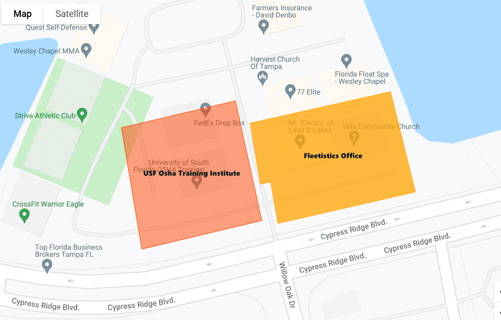
By and large, GPS tracking systems for vehicles include the ability to utilize zones. There are many names used by system providers for zones. Geofences, geozones, landmarks, and points of interest are common terms. They all provide the same ability to define a location on a map that reporting is then based upon. For businesses that use vehicle start and stop time for payroll, just create a zone around the daily point of departure. In most cases, it will be your office or the employee’s home. Create another zone around the daily endpoint. Many times, the endpoint is the same as the starting point. In those cases, the same zone can be used.
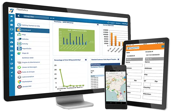
Once the zones or geofences are created, a report can be scheduled. The GPS system will periodically deliver a report that includes the entry and/or exit dates and times of each vehicle from the designated zones. This provides the ability to proactively deliver the start and end times of each vehicle to human resource or billing departments automatically on the schedule needed.
Defining Job Locations
Utilizing a GPS system’s zone or geofence feature, job locations can also be defined within the system. Additionally, you may want to create locations in the system for vendors like parts suppliers and fueling locations. If your system allows for color-coding or classifying types of zones, this can be very helpful. Once the locations are virtually defined, the majority of GPS systems provide the ability to specify tracking or reporting of a vehicle’s entry, exit, time inside, or time outside of a zone. The system can then be set up to report the information to billing departments.
Enter and exit times provide the stop/start points for hourly billing. Additionally, using the vendor zones helps to identify the time outside of a job or customer zone as trips for fuel, supplies, lunch breaks, or something that takes time away from the job/project. It becomes much easier to identify what is billable time and what is not. This information can also be kept and used in the future to estimate a similar job.
Other Zone Attributes
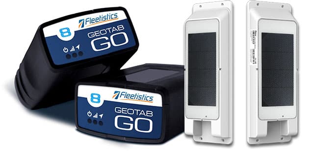
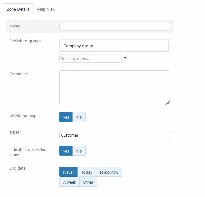
While most GPS systems provide some method for automatically creating zones through the import of an external file such as an Excel spreadsheet, some have more zone management options than others. For instance, the Geotab system provides options for managing these auto-created zones such as expiration and zone type groupings. The Geotab expiration option automatically deletes a zone once the specified date arrives. This assists in managing zones that aren’t used on a regular basis or are associated with a defined time window for a project. If no expiration date is selected, once a zone is created, it can be used indefinitely for recurring jobs for regular customers.
3 Step Plan for Automating Use of Zones in Your GPS System
First, create the zones. Second, passively report arrivals, departures, time inside, and time outside of zones. Finally, proactively deliver a report to accounting or billing personnel. This eliminates the time-consuming tasks required for manually keeping track of payroll hours and time spent on job sites. Compiling the information into an automated report format for your accounting or billing department requires quite literally no action on the part of field personnel or accounting/billing personnel, saving both time and money.
