Visualize Solutions
High Resolution Tracking Data
Unlock Efficiency, Control Costs, and Drive Success.
Fleet GPS Tracking Maps
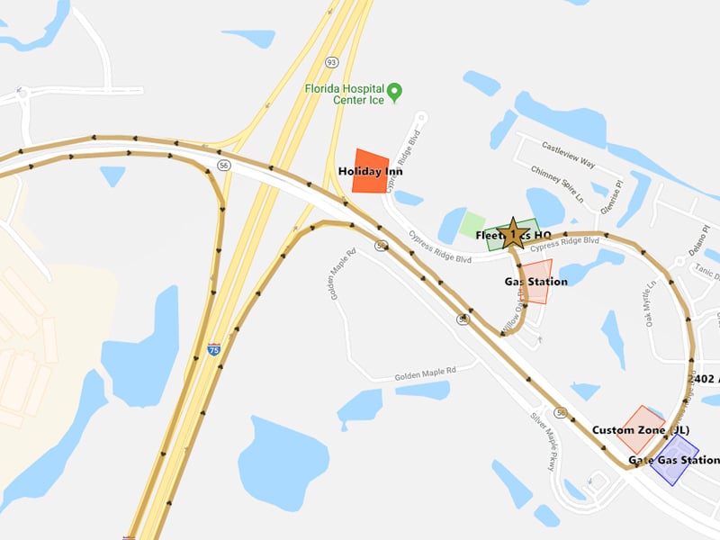
Tracking maps are the primary way in which users will initially interact with a GPS system. Great mapping enables users to quickly review and evaluate the performance of an individual driver or a fleet of vehicles. From just the map view, you can see when all your drivers are on the road every morning and where the closet drivers are to any emergency calls that may arise throughout the day.
Geotab Reseller since 2001!
Pick Your Service Plan
Unparalleled Detail in Tracking Maps
- Choose your resolution from HD to UHD (Pro or ProPlus)
- View vehicles and assets
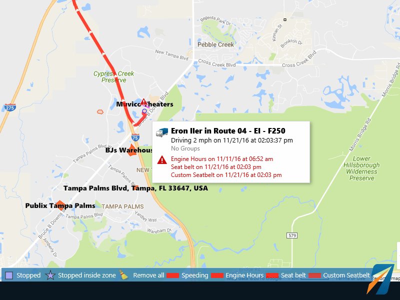
- Exceptions are indicated by a triangle
- Import over 100,000 customer locations (zones)
- Dispatch to nearest vehicle
- Zone exceptions – enter/exit, stop in or out, PTO in zone
- Time in customer or home zone
Note: Map options vary by platform.
Exceptions Detail
The smart map displays exceptions based on the area being viewed. Hover the mouse pointer to reveal the exceptional second-by-second details.
Custom Exceptions
Example: Exit zone by vehicle group A, for more than 65 seconds and a speed greater than 30 mph.
Example: No seatbelt over 10 MPH for more than 30 seconds.
Accident Data
The Geotab system has a secondary accident type memory that samples the accelerometer 100x per second! If you have an accident, this data can aid in understanding the sequence of events.
Exceptions Detail
The smart tracking map displays exceptions based on the area being viewed. Simply hover the mouse pointer to reveal the exceptional second-by-second details. Exceptions can be created from routine data or with custom syntax for various vehicle sizes.
Example: Exit zone by vehicle group A, for more than 65 seconds and a speed greater than 30 mph.
Example: No seatbelt over 10 MPH for more than 30 seconds.
Accident Data
The Geotab system has a secondary accident memory that samples the accelerometer 100x per second! If you have an accident, this data can aid in understanding the sequence of events.
Multiple Options on Tracking Maps
Mapping Layers
There are multiple mapping options which play an important role in the diverse applications of Geotab users. Google maps are the standard and primary mapping application.
Customers can use their ESRI maps with a web map server or utilize OpenStreetMaps.org. Map views can be saved and set to default by
Real-Time Traffic
Traffic overlays assists dispatchers in improve on-time delivery with better impromptu route changes. Large accidents, congestion, snowstorms and other factors can increase transportation expenses due to delays, more miles and added fuel.
Zones or Geofences
Create Complex Zones
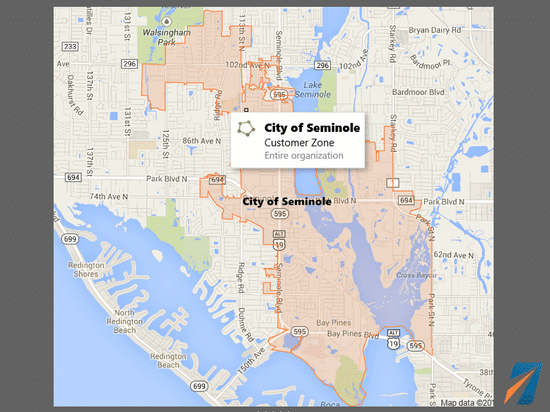
This example zone shows the power you have to create very large and complicated zones or geofences. Notice how the zone has over 100 points in the polygon to encompass a very specific area.
In this example, emergency service vehicles dispatched outside the City of Seminole were able to be billed to neighboring areas for fire and medical services.
Import Zones
Zones can be quickly imported using a .csv file. One customer imported over 150,000 zones!
